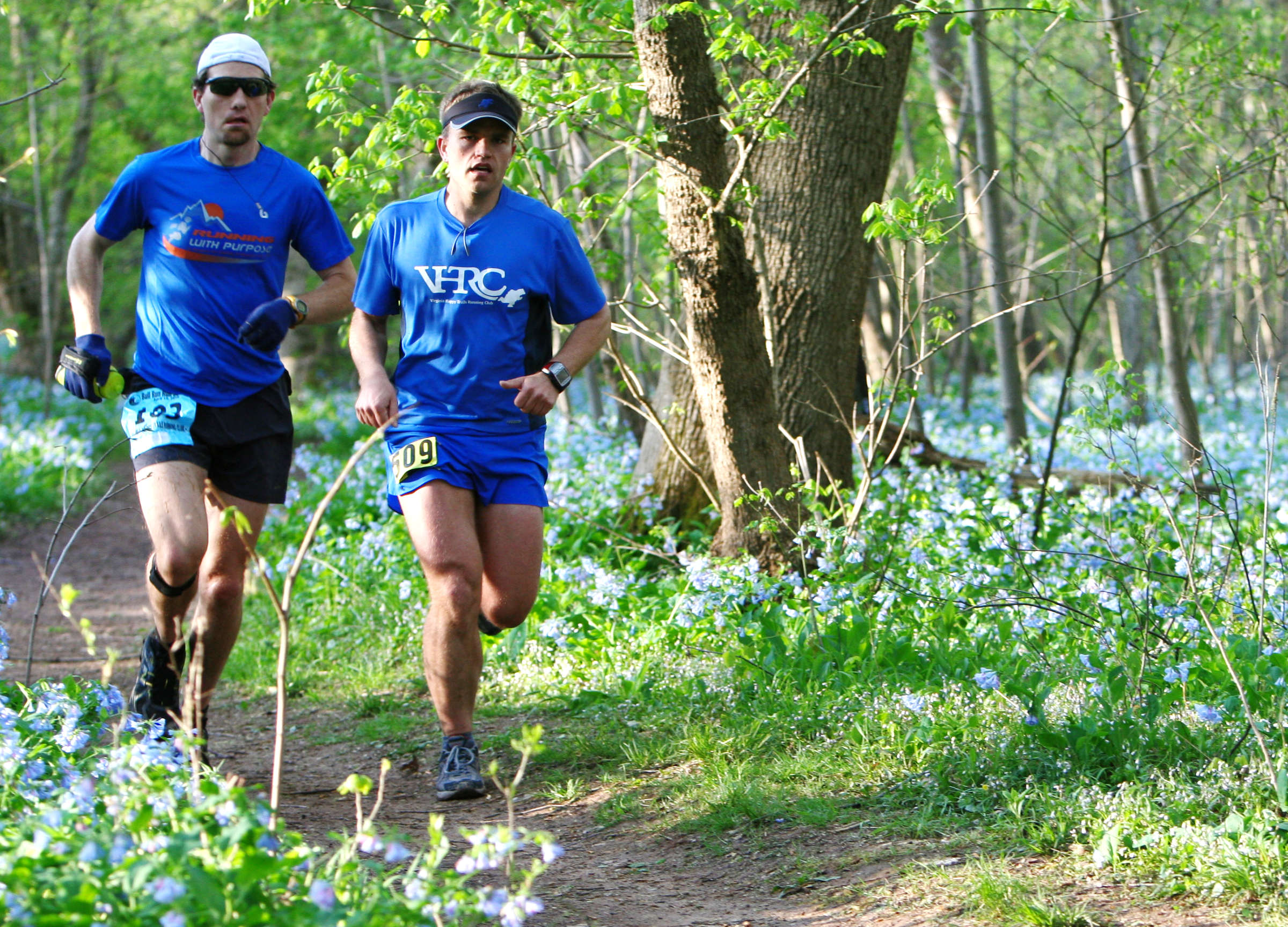
The Bull Run Occoquan Trail meanders through a sea of bluebells.
Mark VanDyke
The Course
This page has information about the course. You don’t need to memorize anything - the course will be very well marked. You may find it helpful to have an idea of where you are on the course at any given time.
- Distance
-
- 50.2 miles
- Total ascent/descent
-
- 5,280 feet
- Aid stations
-
- 12 aid stations
- 7 with crew access, 3 with dropbags
- Time cutoff
-
- 13 hours
The course for the 2026 Bull Run Run 50 should generally be the same as in the past few years. The planned course will use the entire length of the Bull Run-Occoquan Trail (BROT), including the Bluebell Loop at the northern end and the White Loop and the (infamous) Do Loop at the southern end.
The course will be clearly marked on race day, using white ribbons with blue text indicating the correct course. Red ribbon with pink text will tell you where not to run.
View past race reports and photos (thanks, Anstr Davidson!) to get a sense of the course and join us at a training run to experience it before the big day!
The Course
The course is a double out-and-back with a loop at each end (first the Bluebell Loop at the northern end, and then the Do Loop at the southern end). Since you’re retracing your steps as you approach each aid station, be sure to run through the aid station - you’ll never turn around. Read on for details on each section of the course.
The first out n’ back: Hemlock Overlook start line to Hemlock Overlook aid station
- Starting at Hemlock Overlook, runners will take a three-quarter mile loop around the parking areas and a field to spread out the field.
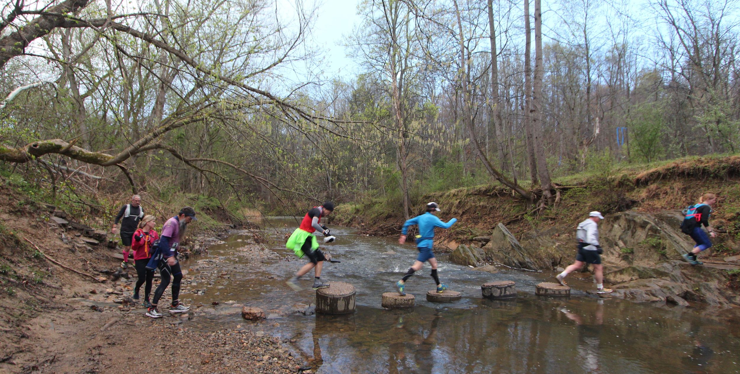
- Heading north (upstream), runners will cross concrete “lily pads” to cross Popes Head Creek to follow the BROT to the first aid station at Centreville Road. You must take the stairs to the aid station for an official finish.
- Continue running upstream until you enter the Bluebell Loop on your right (the loop is run counter-clockwise). Enjoy the beautiful bluebells - take pictures! It’s worth it.
- After a short boardwalk section, you will reach the end of the BROT. The course then goes left for a short paved section; a water stop will greet you very early in this stretch.
- After a third of a mile, the course returns to single track trail, turning left on a connector trail along the Bull Run. This Bluebell Loop ends with a right turn back onto the BROT, and your return across the Cub Run bridge.
- Retrace your steps back to Hemlock. Yes, you must go back up the stairs to the Centreville Aid Station for an official finish.
- Remember the climb back up to Hemlock, as you’ll cross it again to finish the race!
The second out n’ back: Hemlock Overlook aid station to Hemlock Overlook finish line
- After passing through the Hemlock Overlook aid station (and accessing your drop bag, if needed), runners will descend the same hill from the beginning of the race and will turn left at the bottom, heading southbound (downstream) on the BROT.
- On your way to the Marina aid station, you will run primarily on single-track and will pass through open sections with soccer fields.
- After the Marina aid station, rejoin the BROT by descending to a bridge underpass on the waterside. Watch your head!
- Next, pass through the Wolf Run Shoals aid station (prepare for a party at this aid station!).
- After Wolf Run Shoals, run another three miles before hitting the Fountainhead aid station. Follow the signage closely to help you navigate the White Loop before heading to the infamous Do Loop.
- Fuel up at the Do Loop aid station before entering the Do Loop - the final loop of the course! It’s tough but you’ll get through it.
- In the middle of the Do Loop you will pass by one of two memorial benches dedicated to the memory of long-time VHTRC member and BRR runner Ed “Cappuccino” Cacciapaglia.
- After surviving the Do Loop, you’ll go back to Fountainhead - you will not repeat the White Loop.
- Retrace your steps on the BROT, bypassing the initial descent to the BROT as you will approach the finish line up the same climb from the first out n’ back.
- You will pass the second memorial bench to our friend Ed Cappuccino at a point that is exactly one mile from the race finish.
Important note regarding the table below: The cut-offs posted below for the earlier aid stations (through Do Loop In) are suggested only. These “soft cut-offs” are posted to alert you to the fact that, historically, runners who pass through those aid stations after the suggested times do not finish the race under the final cut-off. So you will want to start to step it up a bit to stay ahead of those looming hard cut-offs that start at mile 35.5 (Do Loop Out). Those hard cut-offs are enforced.
Elevation change
The course has a lot of little ups and downs. None of these is greater than a 200 foot elevation change and most are about 150 feet. While the elevation profile below may look dramatic, bear in mind that the major ticks for elevation are in increments of only 50 feet. The cumulative elevation gain is about one mile — i.e., 5280 feet.
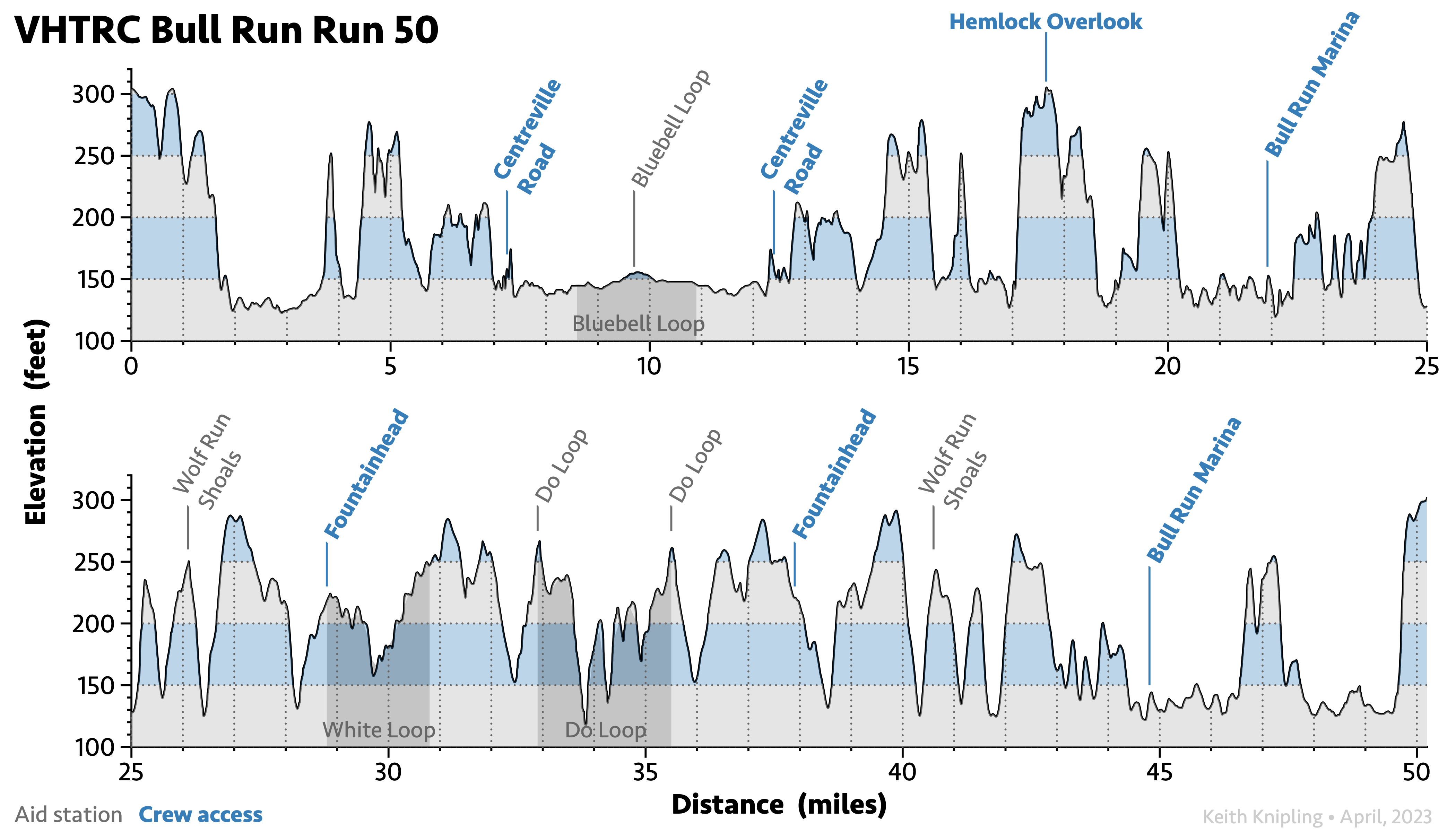
Some of the hills on the course are gentle, a few are rather steep. None is long. The start is just over 300 feet above sea level and no other place on the course is higher. At its lowest, the course is about 115 feet above sea level. The only long, flat section of the course is early in the race, on the Bluebell Loop (northern) end, where there are about five flat miles (that you go out and then loop back on).
Like most rivers, the Bull Run and Occoquan have carved a valley. The trail generally follows the course of the river. Sometimes the trail is on the edge of the river, sometimes on a nearby bank or cliff. Going up and down from the river’s edge to the bank causes much of the elevation change.
We count about 20 climbs of ~150 feet. There are another four or five ~50 foot climbs. The net elevation change is zero since the start and finish are at the same place.
Trail Surface
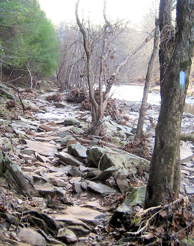
This is almost entirely a single-track dirt trail. Other than a few short (~200 yard) rocky sections, most of the course is runnable. (The rocky sections are runnable if you are good.) There can be rocks, roots, mud, and fallen trees anywhere. There are several stream crossings. Most of the big ones (but not all!) have bridges. Those bridges, however, can be slippery and unstable. In dry weather you may be able to keep your feet dry. If it has rained before or during the event, you will not be able to keep your feet dry.
Meteorological Information
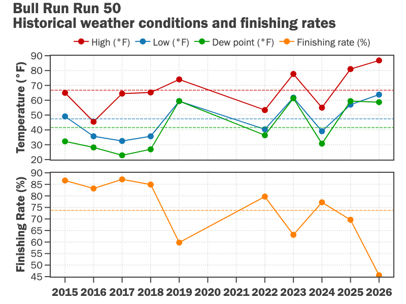
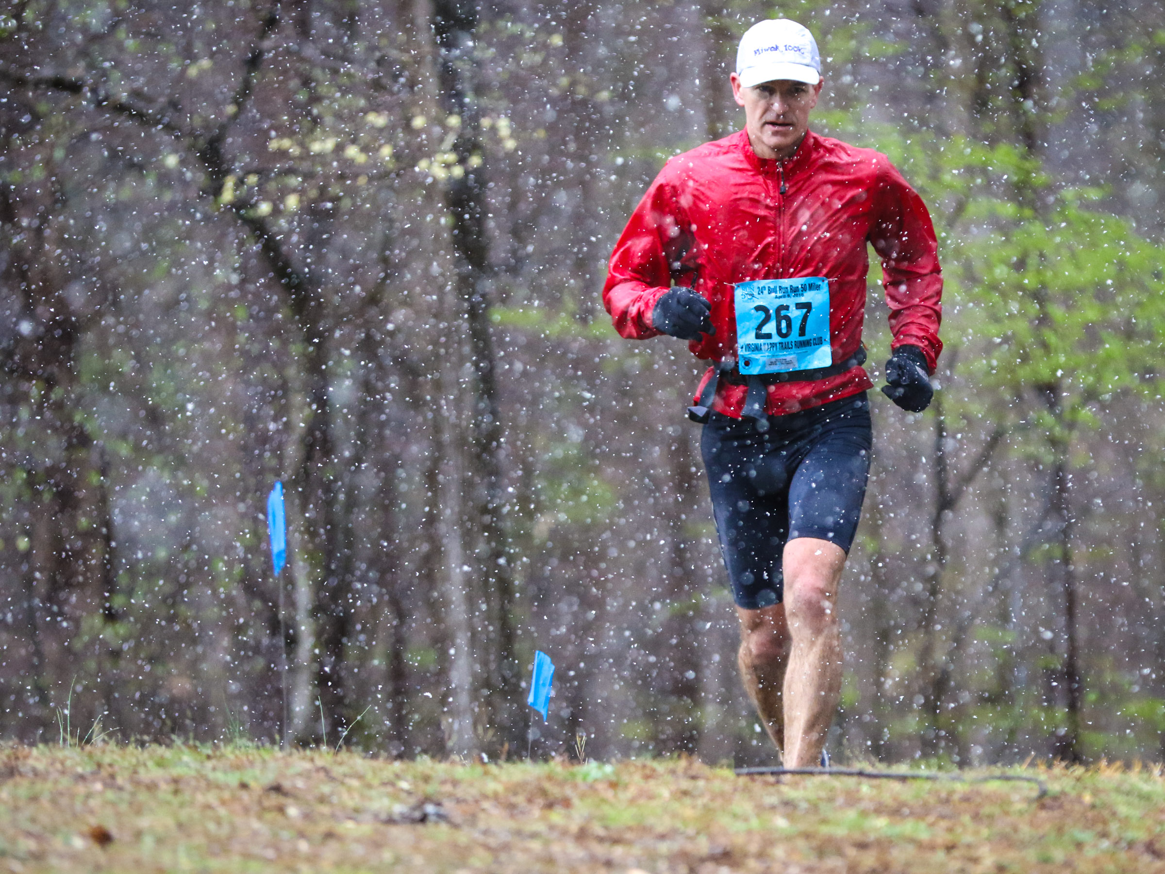
April in Virginia can be unpredictable and runners should be ready for any weather. Temperatures are often freezing at the start, only to soar into the upper 60s or lower 70s (°F) later in the day. More often than not, however, the weather is ideal for running. Over the years we have had runners suffer from both hypothermia and heat stroke. Watch the local weather and plan accordingly.
Read the local weather forecast.
Cutoff Times
The race has a 13-hour time limit. There is a very generous early cut-off at the fourth aid station at Hemlock at 17.6 miles. There are also three aid station locations late in the race that a runner must depart by specific times to continue in the race. These times are generously calculated to allow the runner time to meet the 13-hour overall time limit. There are no exceptions to these cutoffs. Any runner who continues after being asked to give up his or her race number will be banned from all future VHTRC events and bears all responsibility for his/her safety.
Special Note
You must finish the race before 7:30 pm to be an “official finisher.” If, however, you leave the Bull Run Marina aid station not later than its 6:00 pm cut-off and make steady progress but finish after 7:30, you will receive the finishers’ award and be listed on the results page. It just won’t be counted as an “official” finish.
If There is High Water
If the water in Bull Run is high, we may have to change the course. There is a high-water course planned in case we need it.