The Course
The MMT is a challenging 100 mile trail ultra over a demanding, rocky course in the Massanutten Mountains of Virginia’s Shenandoah Valley. The course includes short but rugged mountain climbs that total over 18,500 feet.
- Distance
-
- 100.6 miles
- Total ascent/descent
-
- 18,500 feet
- Aid stations
-
- 15 aid stations
- 8 with crew access, 10 with dropbags
- Time cutoff
-
- 36 hours
Course map
The course can be thought of as two “almost loops” that follow the ridges of the Massanutten Mountains, roughly resembling a top-heavy figure-8. The pins mark aid stations, color-coded by their accessibility to crews. Crew access; No crew access; Drop bag only.
The first loop of the figure-8 starts from the Caroline Furnace Lutheran Camp. After a short stretch on dirt road to the west, the course runs clockwise north up the western ridge of the Massanuttens to Elizabeth Furnace (Aid Station 5, 33.3 miles). The course then ascends the eastern ridge and follows that, with periodic descents off the ridge to the aid stations, south to Gap Creek I (Aid Station 11, 69.6 miles).
The second, smaller, loop begins at Gap Creek I and goes counter-clockwise, following Kern’s Mountain south to Bird Knob before returning north back to Gap Creek II (Aid Station 15, mile 96.8).
There is a printable map of the course, displayed below and also available as a two-page PDF for printing (2.4 MB download).

Elevation profile
The course features approximately 10 climbs of 750 vertical feet or more. While none of the climbs is terribly long, many are steep and waiting for you at the top is a rocky ridgeline. The course is tougher than it looks on paper.
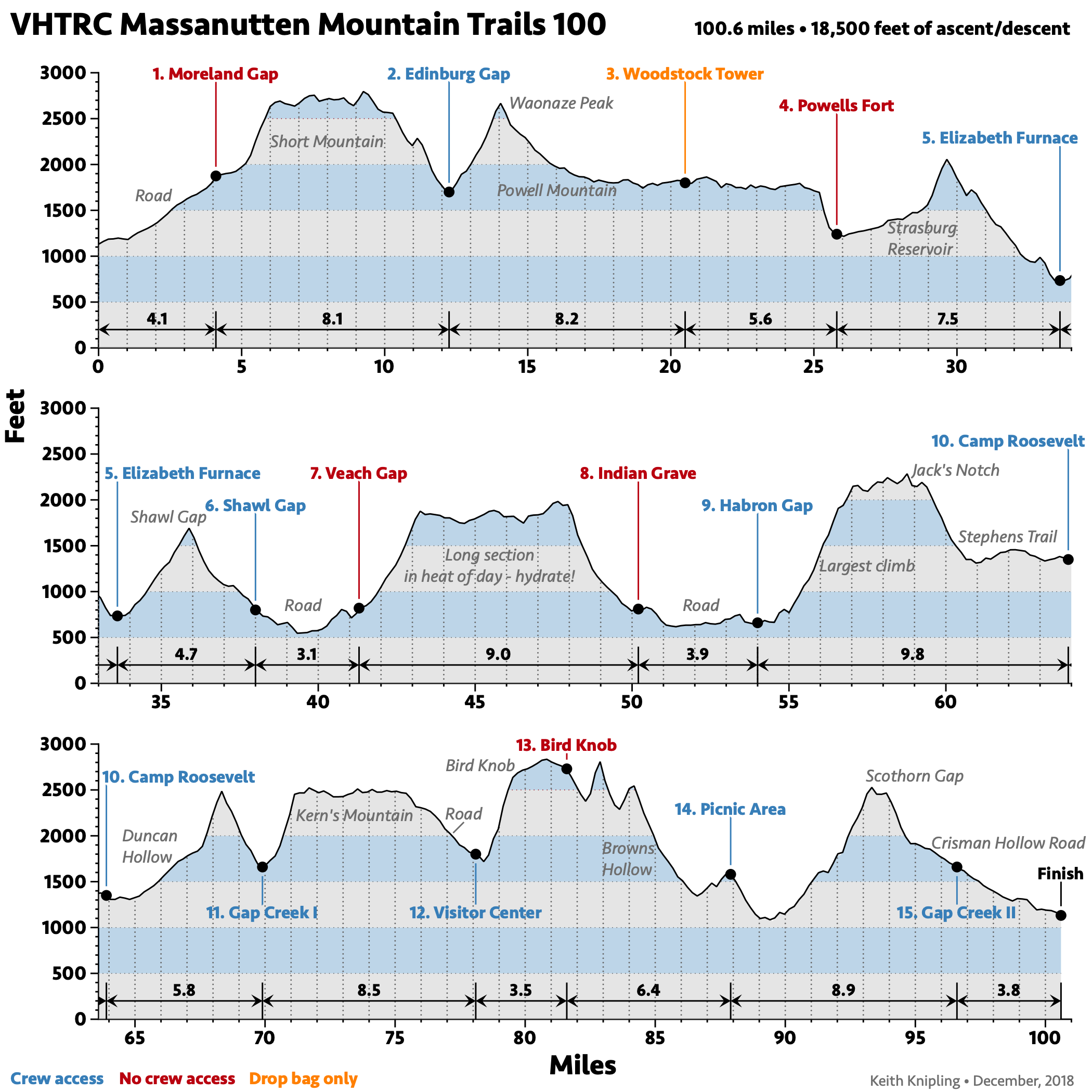
The high point is 2,835 feet (at Bird Knob, mile 81). The low point is 540 feet (mile 39, between Shawl Gap and Veach Gap). The longest individual climb — 1,550 feet in 2.5 miles — comes at mile 55, just after the Habron Gap Aid Station.
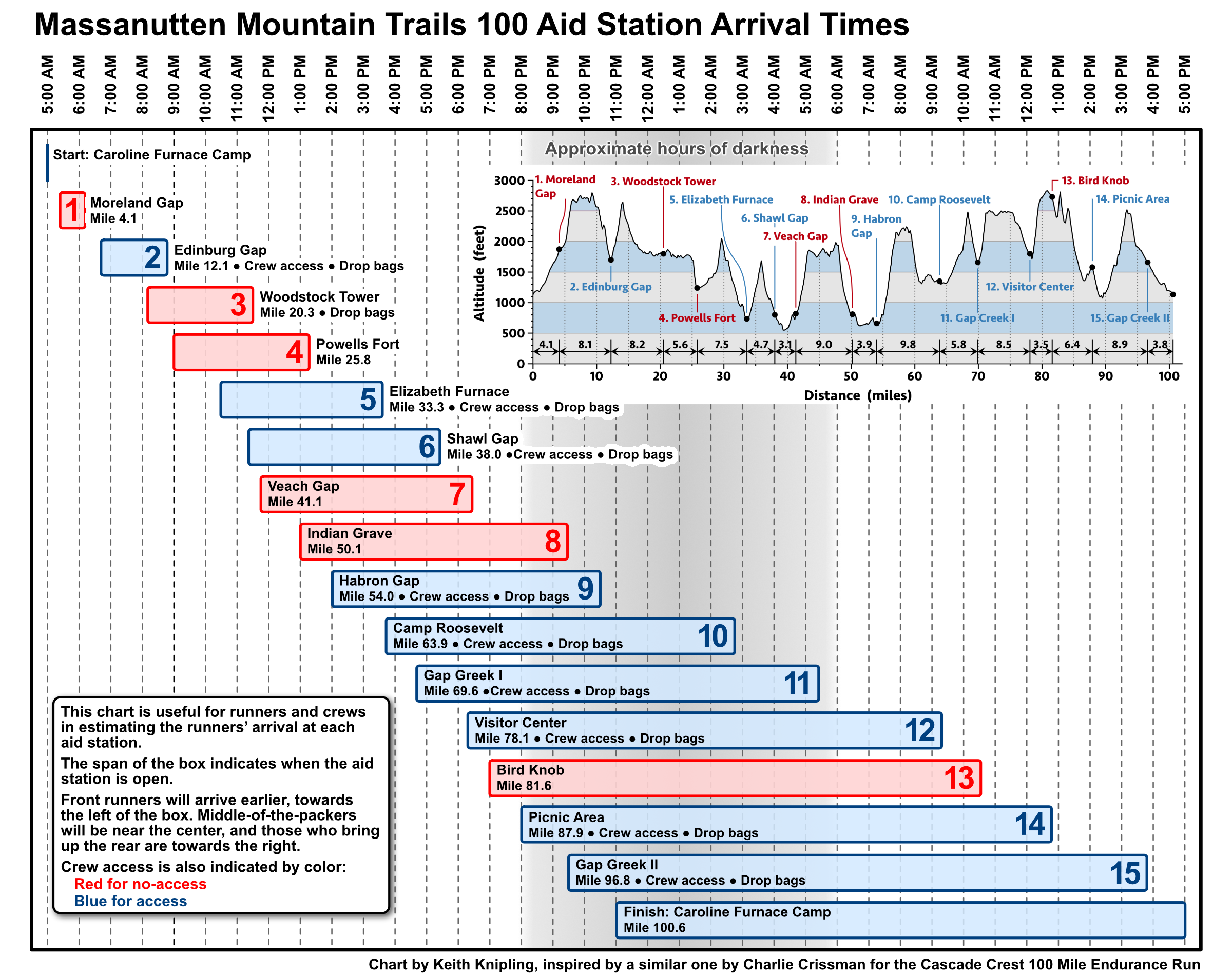
Aid stations
MMT features 15 aid stations, 9 of which are crew-accessible. The table below lists mileages for the aid stations as well as crew and drop bag accessibility.
The following chart is useful for runners and crews in estimating a runner’s arrival time at the various aid stations. Download a printable PDF (1.4 MB download).
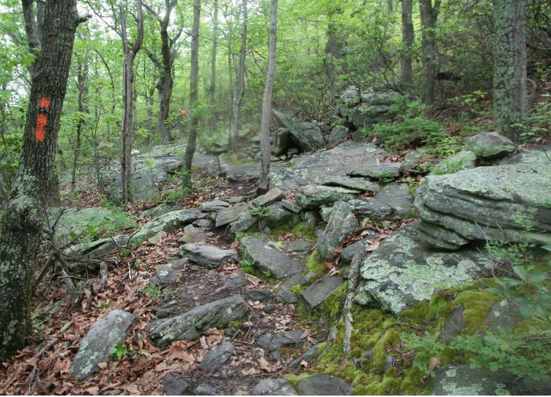
Course markings
The course will be marked with yellow surveyor’s tape. Red tape will bar entry to trails you shouldn’t take. Never cross a red ribbon. There will be reflective markings for the the portions of the course traveled at night. While the VHTRC has an established reputation for a well-marked course, that doesn’t mean you can’t get lost if you don’t pay attention.
Meteorological information
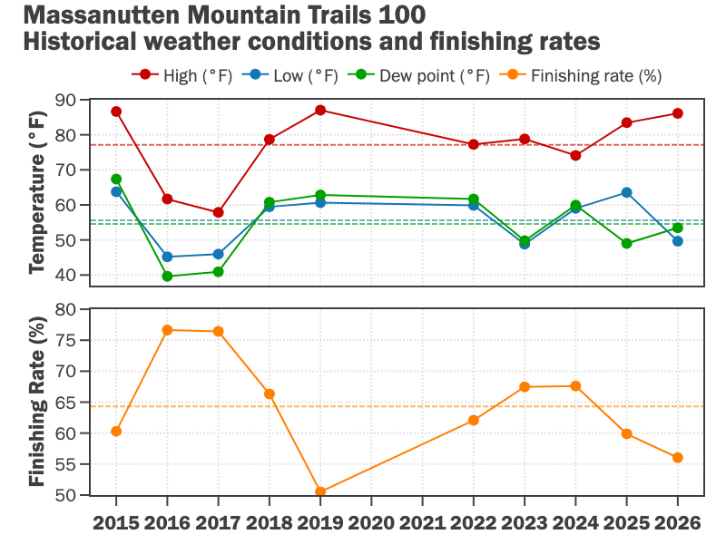
While the May date usually avoids Virginia’s brutal summer weather, we have had hot years (with corresponding low finishing rates). Other years have been cool, with high temperatures failing to get above 60 °F. In general, typical daytime highs are in the 70s (°F) and the coldest parts of the course can dip into the 40s (°F). Temperatures rarely get below freezing, but on the ridges it can get chilly, especially for slow-moving runners late in the race. It often rains at some point during the weekend, and we have had torrential rain and violent storms in prior years.
Read the local weather forecast.
PATC Maps
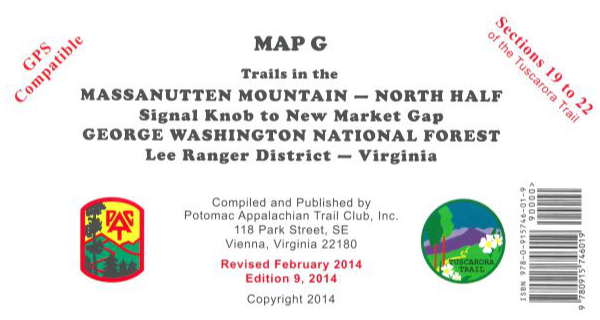
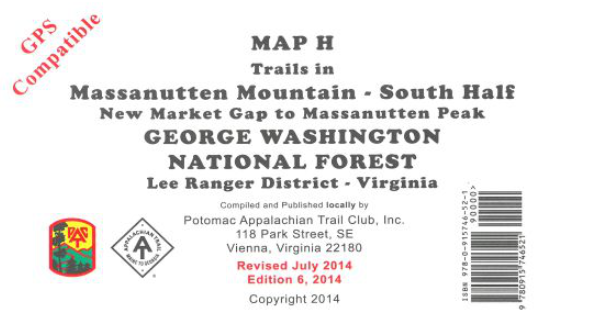
Unless you know the course well, we recommend that you obtain Potomac Appalachian Trail Club (PATC) maps G and H. These are topographic maps that cover the trails in the Massanutten Mountains — north of US 211 (Map G) and south of US 211 (Map H). Both maps are printed on water-resistant, tear-resistance synthetic stock in six colors. Most of the course is on map G. Only the Bird Knob section of the MMT course is on map H. The PATC also has a Guide to the Massanutten Mountains updated in 2013 (available as a separate item or in a set with maps G and H). There are discounts for PATC members.
You can order these maps on the PATC Web site.
Map G is also available at REI.