Historic Hazel Loop
Most of the trails in Shenandoah National Park are old roads, vestiges of the mountain communities that dotted the hillsides prior to the park. This loop passes by countless homesites in the hills around Hazel Mountain on the outskirts of Sperryville.
- Distance
-
- 12.4 miles
- Running time
-
- 2.5–4 hours
- Total ascent/descent
-
-
3,300 feet
270 feet/mile
-
3,300 feet
- Start/finish
- GPX file
- What to wear
Directions
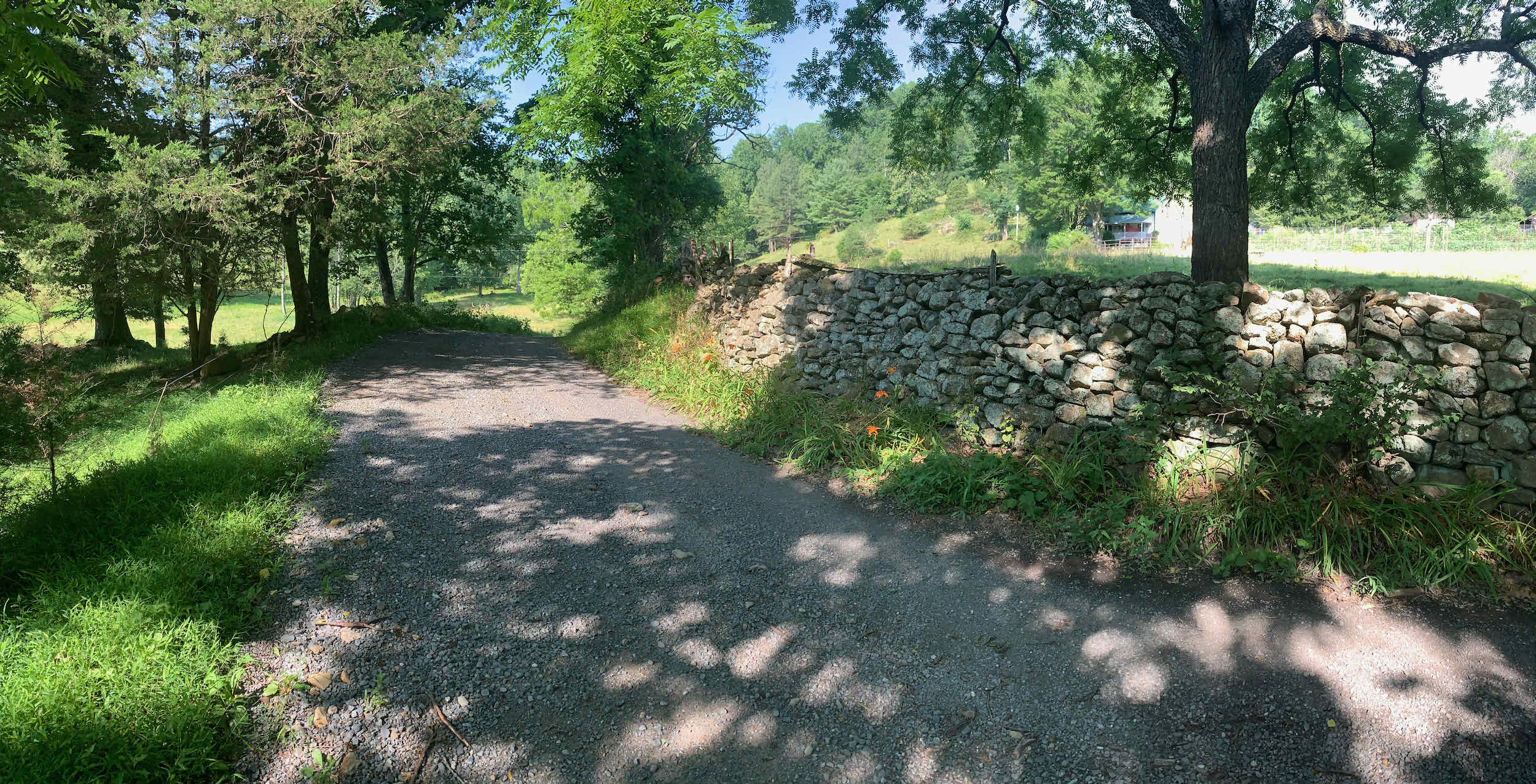
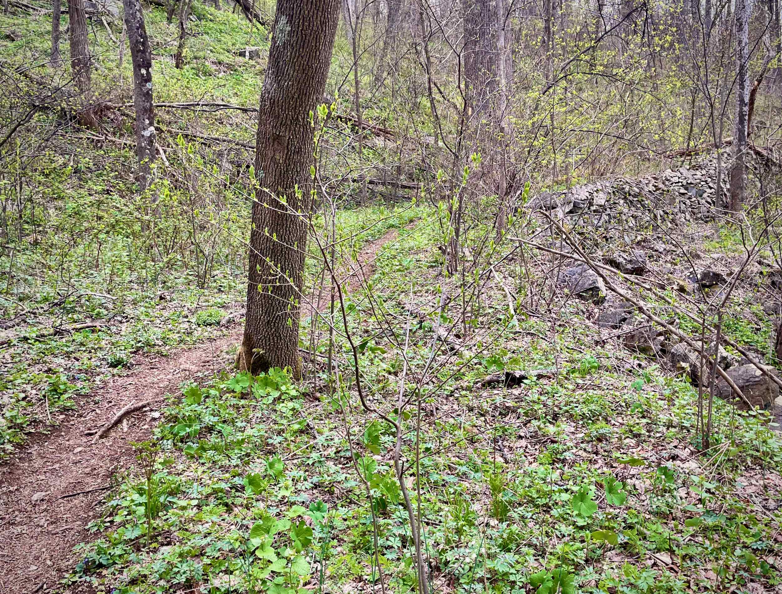
From the gate, gradually climb Hungry Horse Lane along the Hazel River for 0.3 miles. Intersect the Hazel River Trail and continue along the river for a short distance to Sam’s Ridge Trail.
Take a left onto Sam’s Ridge and begin the steep ascent, climbing nearly 1,500 feet in less than two miles. There is a homesite just off the trail to the left, at around 2,450 feet of elevation (see the 1933 map below). After 2.4 miles, intersect the Broad Hollow Trail and take a left.
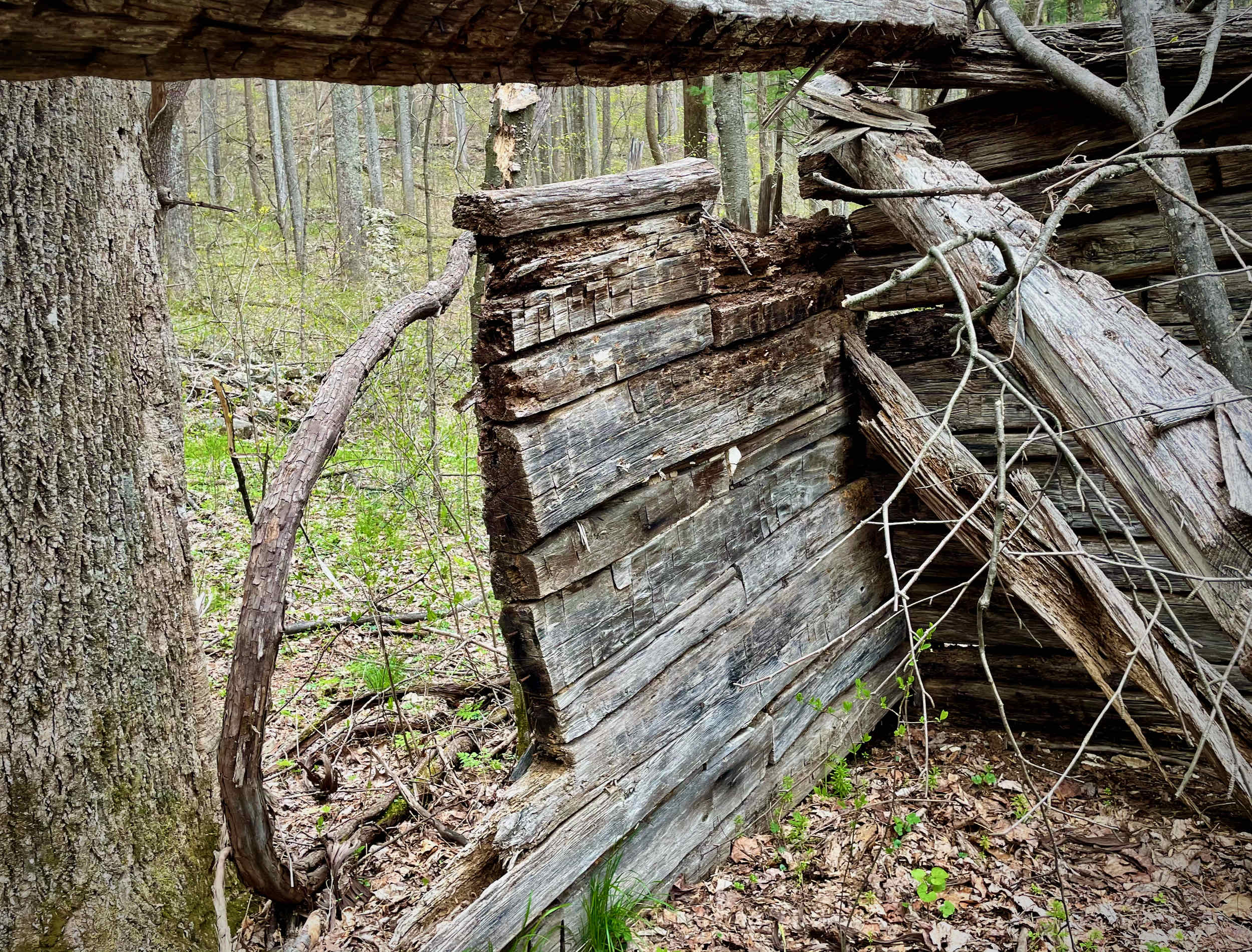
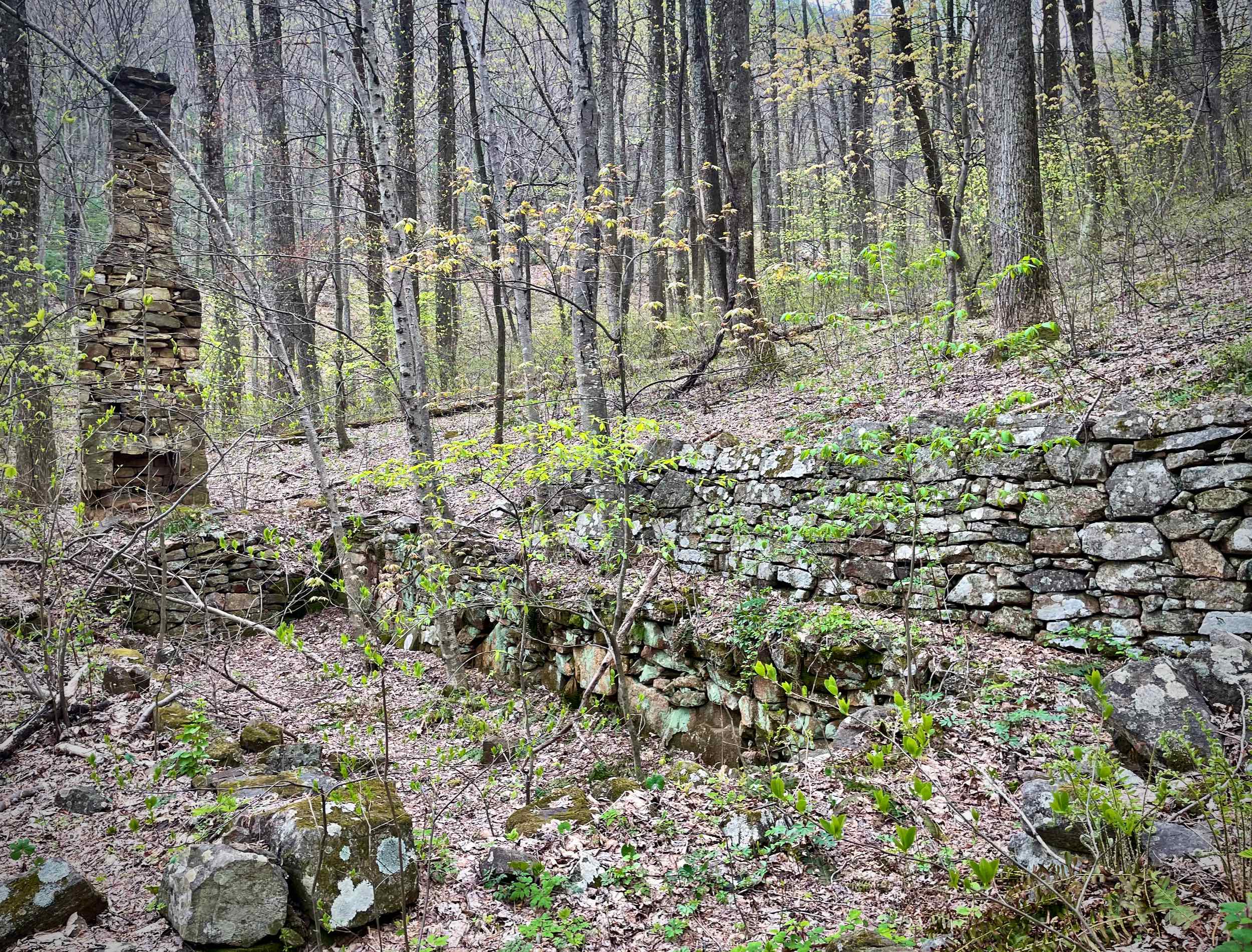
Descend down Broad Hollow for 2.2 miles, passing by a a still-standing mountain homestead about halfway down. After passing the homesite, you will step right over the well-preserved springbox. As noted in the Virginia DHR Reconnaissance Level Survey (078-5165), there are also granite fieldstones marking a family cemetery to the west of the trail.
Broad Hollow ends at Rolling Road. Take a right and follow the gravel road for 0.4 miles to the Pine Hill Gap Trailhead.
Take the Pine Hill Gap Trail and begin the second climb of the day. You will pass right by a hard-to-see homestead at around 2,300 feet elevation (see the 1933 map below).
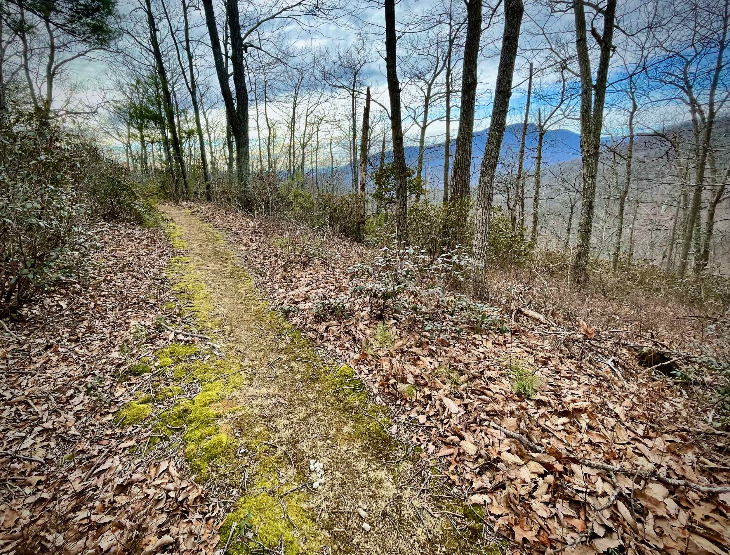
At the top of the climb, near mile 6.8, the trail becomes the Hazel Mountain Trail. Within 20 feet of the post, look for an unofficial trail off to the left to a spectacular view of Old Rag, Nicholson Hollow, and Stony Man.
Continue on the Hazel Mountain Trail. For the next 1.5 miles you will intersect several trails, evidence of the bustling community that was here in the early Twentieth Century. The Hazel Mountain trail, which you are on, was once a major road that connected the Hazel Mountain area to Beach Spring Hollow, on the outskirts of Sperryville.
In 0.35 miles, intersect the Hot Short Mountain Trail. Stay right on Hazel Mountain. In another 0.5 miles intersect the Catlett Mountain Trail and, again, stay right on Hazel Mountain. In another 0.5 miles come to a third trail intersection with the Sam’s Ridge Trail. Near this crossroads was the Hazel School.
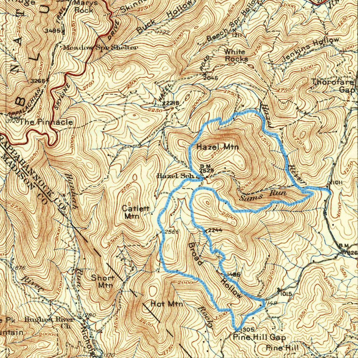
Source: USGS 1:62500-scale Quadrangle for Stony Man, VA 1933.
Bear left, staying on the Hazel Mountain Trail, for 0.2 miles and the intersection with the Hazel River Trail. Take a right onto the Hazel River Trail and enjoy a nice, runnable downhill on an old roadbed.
Near mile 10, at 1,900 feet of elevation, look for a well-preserved homesite down and to the right. As noted in the Virginia DHR Archaeological Site Record 44RA0112:
The site appears to be one of the largest and most well preserved farm/homesites in the park, containing a house foundation with full standing chimney, three outbuilding foundations, a spring house, spring box, and extensive agricultural activity.
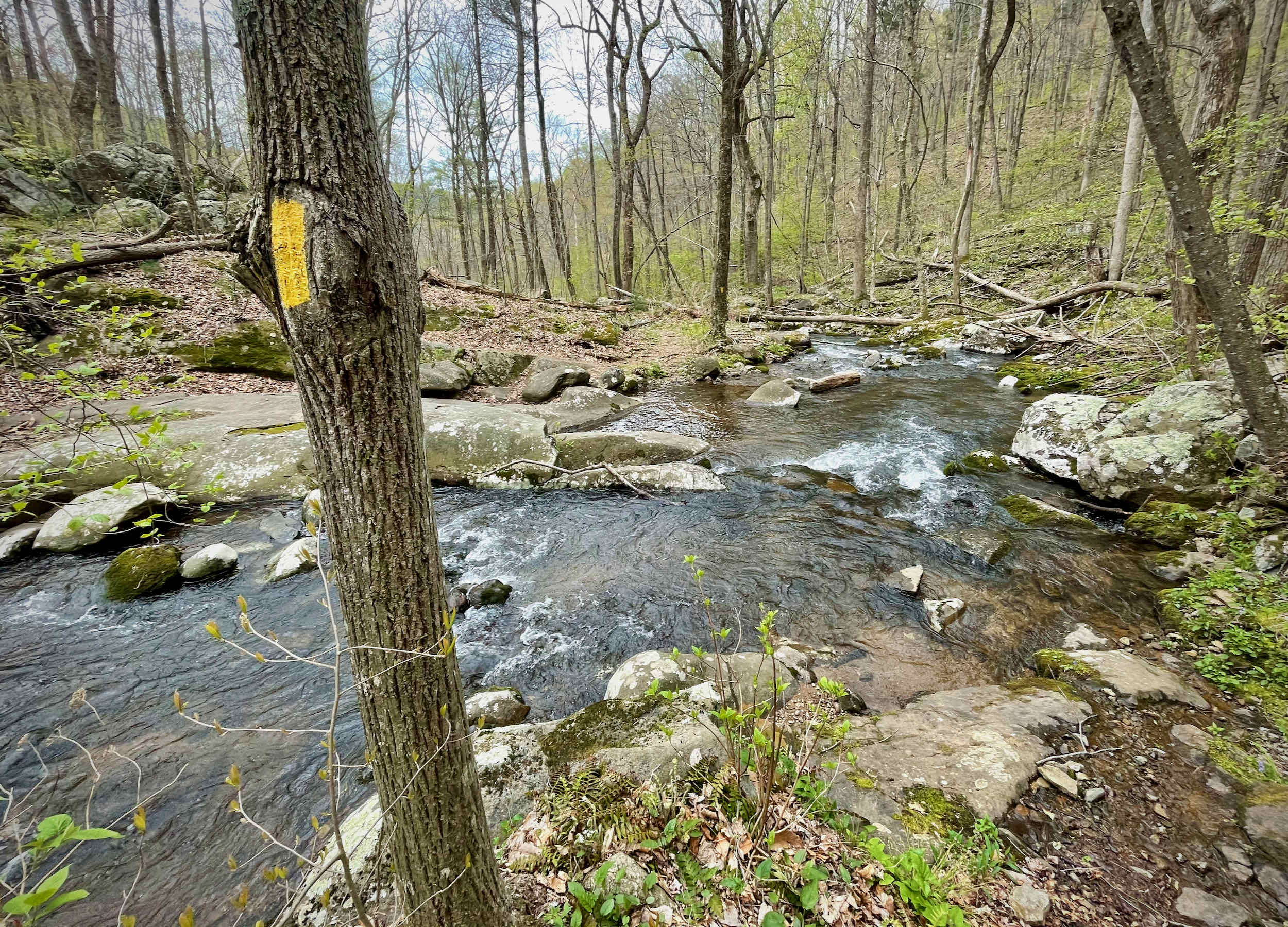
At 10.5 miles, intersect the White Rocks Trail coming in from the left. Stay on the Hazel River Trail and crisscross the river for 1.5 miles, passing by a few more homesites.
At the road, it is 0.3 miles down Hungry Horse Lane back to your car.
Historical resources
Thanks to Quatro Hubbard and the Virginia Department of Historic Resources, we have several archaeological site records for some of the historical features on this loop:
- The homesite and cemetery along the Broad Hollow Trail (mile 3.5): Virginia DHR Archaeological Site Record 44RA0046 and Virginia DHR Reconnaissance Level Survey
- The homesite along the Hazel River Trail (mile 10): Virginia DHR Archaeological Site Record 44RA0112)
Last updated May 11, 2021
What you do is up to you, but you shouldn't rely on these directions alone; they are often not specific enough to navigate by, and may be incorrect or out of date. Review a map beforehand and carry it with you. Tell a friend where you are going and when you plan to return. Do not count on having cell phone service while on the run. The VHTRC is not responsible for your welfare on any of these runs. If you go on one of these runs and get lost, run out of water, get injured, mauled by a bear, or die, or if anything else goes wrong, it's your fault; not ours. You assume all risks here and the VHTRC assumes none at all. Legal issues aside, some of these runs are more remote than others and the VHTRC is not suggesting that you do any of these runs, unless you are prepared to accept full responsibility for yourself.