Bear Church Rock - Staunton River - Rapidan River Loop
A scenic climb along the cascading Staunton River with a detour to the spectacular Bear Church Rock along the way. The second half is all downhill, descending the scenic Fork Mountain Road and then following the pristine Rapidan River back to the trailhead.
- Distance
-
- 12.6 miles
- Running time
-
- 3–5 hours
- Total ascent/descent
-
-
2,700 feet
215 feet/mile
-
2,700 feet
- Start/finish
- GPX file
- What to wear
Directions
From the trailhead, ascend gently on the yellow-blazed Graves Mill Trail along the Rapidan River. After 0.5 miles, take a left onto the blue-blazed Staunton River Trail, following the Staunton River through a picturesque gorge wrapping along the base of Jones Mountain.
In 2.2 miles, turn left onto the Jones Mountain Trail and begin climbing away from the river, reaching the McDaniel Hollow Trail in 0.5 miles. Keep left on the Jones Mountain Trail. Shortly after passing through a tunnel of old-growth mountain laurel, reach the side trail to the Jones Mountain Cabin.1
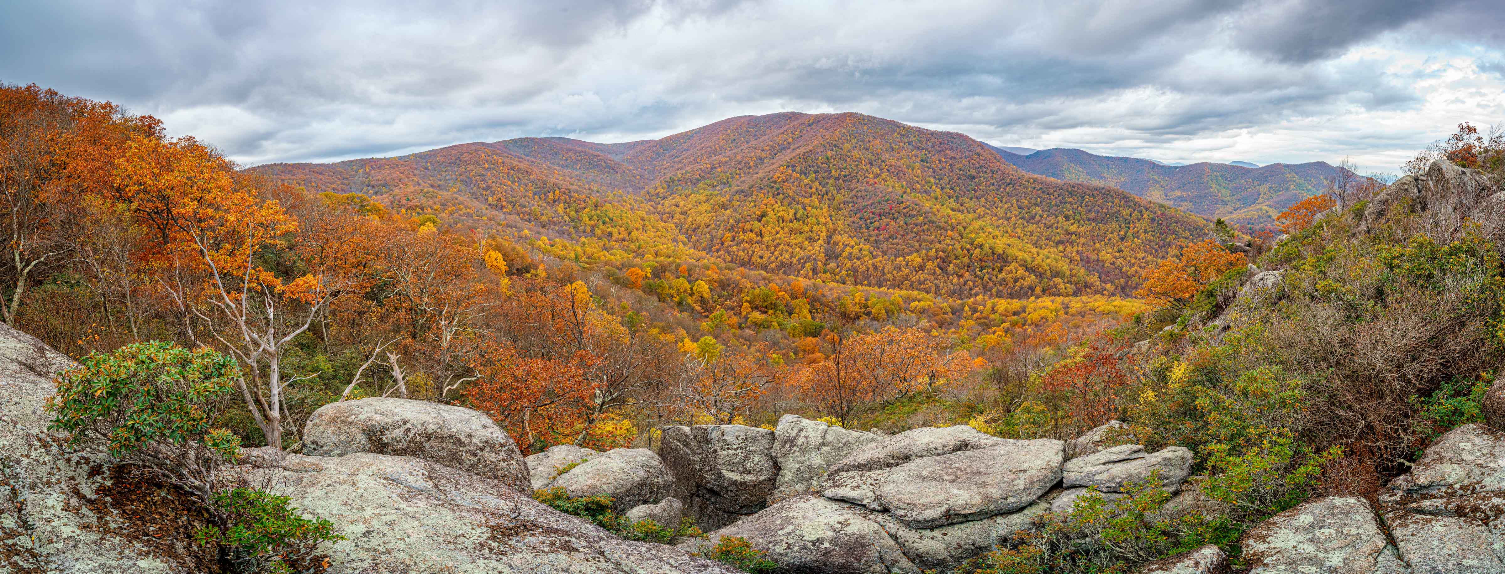
From here, climb for a little less than half a mile, reaching the ridge of Jones Mountain and a short trail off to the right to the spectacular view from Bear Church Rock. The view is not marked so be sure not to miss it.
After taking in the view, retrace your steps back down the Jones Mountain Trail, past the side trail to the Jones Mountain Cabin and down to the McDaniel Hollow Trail (mile 4.5). Take a left and follow the McDaniel Hollow Trail for 0.4 miles to the Staunton River Trail. Take a left onto the blue-blazed Staunton River Trail and climb for 1.4 miles along the beautiful cascading Staunton River.
At mile 6.25, reach the Fork Mountain Road and take a right, descending 3 miles and 1,300 feet down to the intersection with the Rapidan Fire Road (mile 9.25).
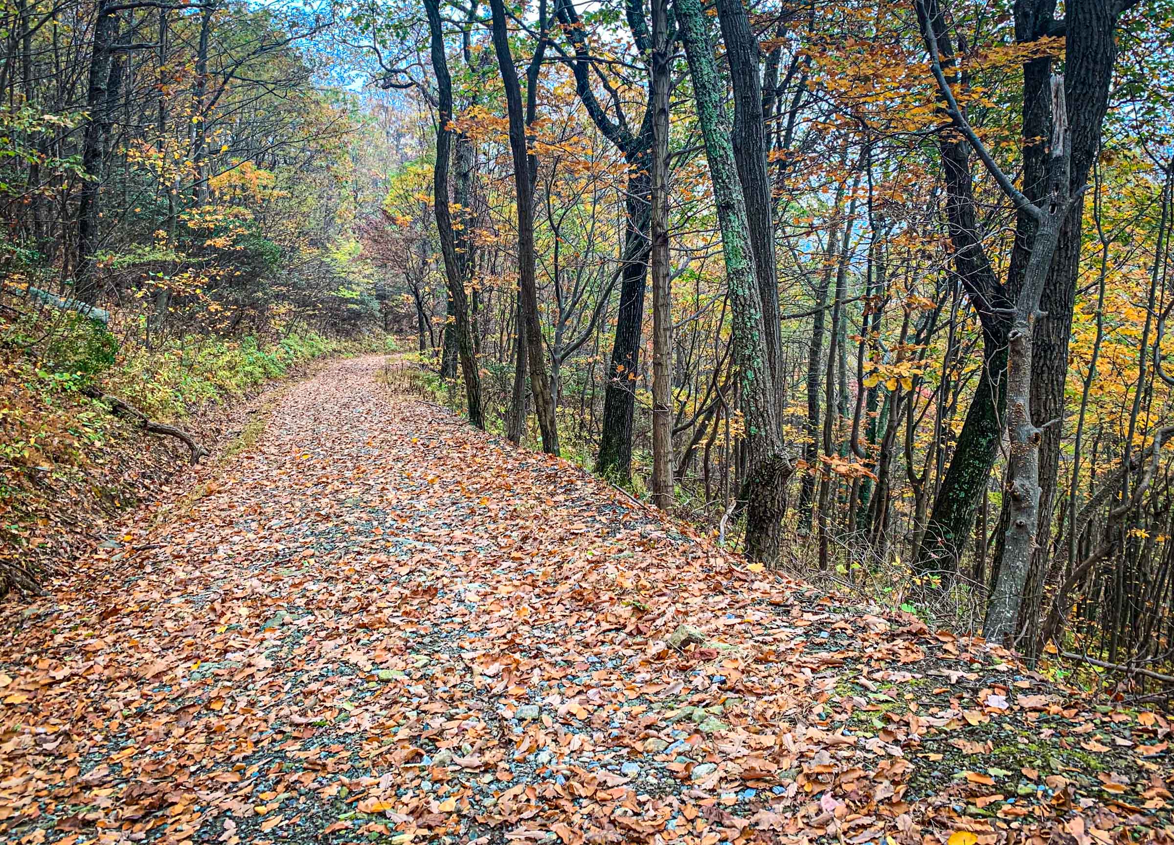
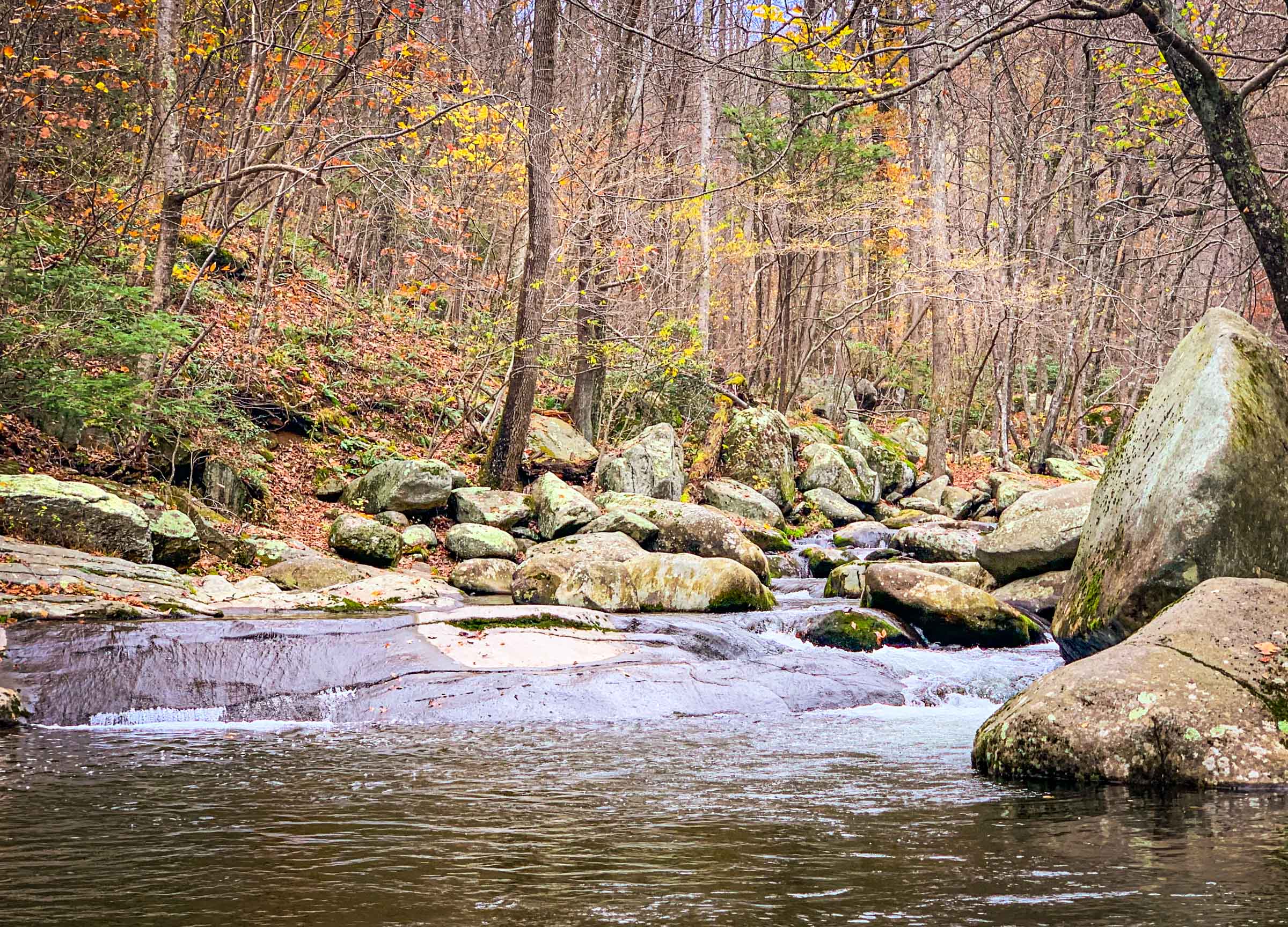
Take a right on the Rapidan Fire Road and follow the Rapidan River 1.3 miles downstream to the Graves Mill Trail. Leave the road and follow the yellow-blazed Graves Mill Trail for 1.7 miles, crossing the Rapidan River several times (this makes for great swimming in summer). Intersect the Staunton River Trail at mile 12.2, and stay on the Graves Mill Trail for 0.5 miles back to the trailhead.
-
The Jones Mountain Cabin is a chestnut log cabin built by moonshiner Harvey Nichols in 1918 and is well-preserved vestige of the types of mountain homes that dotted these mountains before the establishment of the national park in 1935. The cabin can be reached on an optional 0.6-mile round-trip out-and-back. ↩
Last updated November 1, 2020
What you do is up to you, but you shouldn't rely on these directions alone; they are often not specific enough to navigate by, and may be incorrect or out of date. Review a map beforehand and carry it with you. Tell a friend where you are going and when you plan to return. Do not count on having cell phone service while on the run. The VHTRC is not responsible for your welfare on any of these runs. If you go on one of these runs and get lost, run out of water, get injured, mauled by a bear, or die, or if anything else goes wrong, it's your fault; not ours. You assume all risks here and the VHTRC assumes none at all. Legal issues aside, some of these runs are more remote than others and the VHTRC is not suggesting that you do any of these runs, unless you are prepared to accept full responsibility for yourself.