Strickler and Duncan Knobs Loop
- Distance
-
- 14 miles
- Running time
-
- 3–5.5 hours
- Total ascent/descent
-
-
2,180 feet
160 feet/mile
-
2,180 feet
- Start/finish
- GPX file
- What to wear
This “P”-shaped loop features two outstanding vistas of the northern Massanuttens — Stricker Knob and Duncan Knob. Note that the trail to Strickler Knob is not official, but it is blazed (magenta), well-traveled, and fairly easy to follow. It is, however, extremely technical in places.
The trail was established in the mid 2000s, and was first documented in a 2006 article on the VHTRC web site. Now, Strickler Knob is the most popular hike in that area of the Massanuttens. Anyone you see hiking up Big Run or Scothorn Gap Trail is likely headed there.
Directions
Leave Camp Roosevelt parking area, cross paved State Route 675, and look for the orange-blazed Massanutten Mountain Trail. Follow for 3.3 miles up Duncan Hollow to intersection with Gap Creek Trail. (Remember this intersection; you will come back by here near the end of the run.) Stay on Massanutten Trail, ascending Duncan Hollow, for another 2.2 miles.
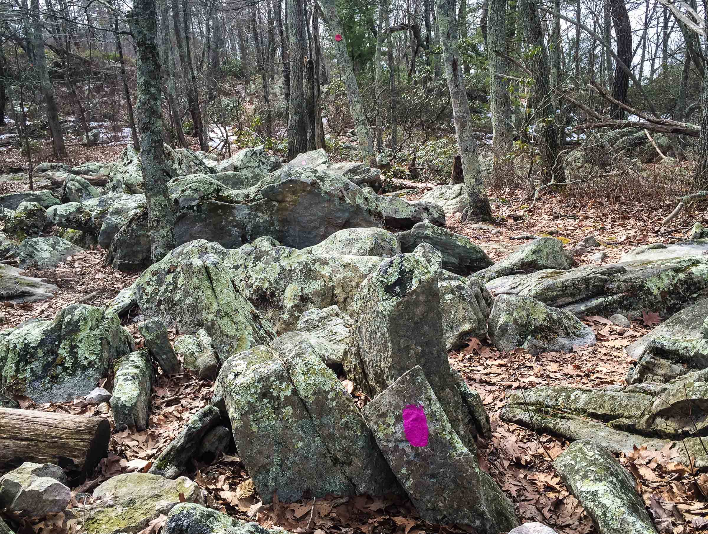
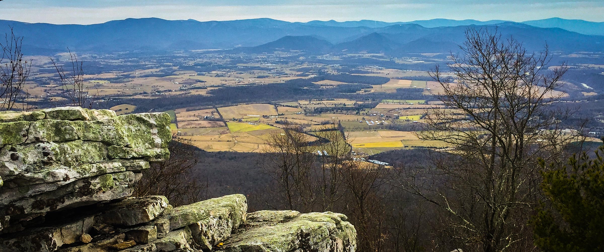
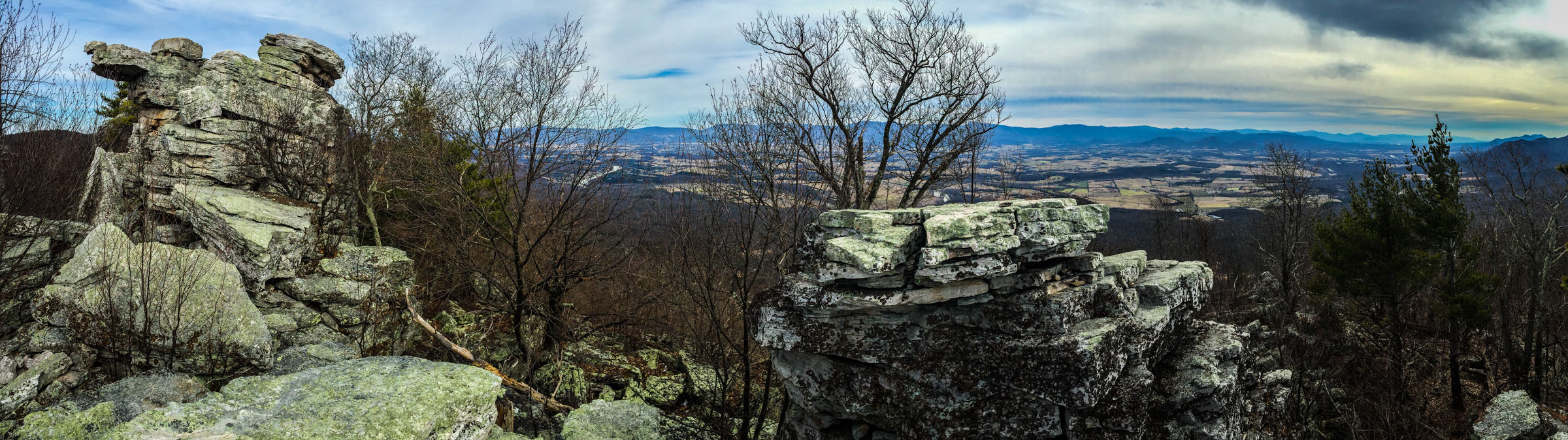
At the crest of the ridge, look to your left for magenta blazes, marking the beginning of the spur to the Strickler Knob. Take the 0.75 mile rocky trail out to the end of the ridge, which is marked by a series of rock pillars with 360° views of the Shenandoah Mountains and Page Valley.
Upon returning to the Massanutten Trail, turn left and descend 0.6 miles to intersection with yellow-blazed Scothorn Gap Trail. Turn right on Scothorn Gap Trail and continue 1.6 miles to intersection with the Gap Creek Trail.
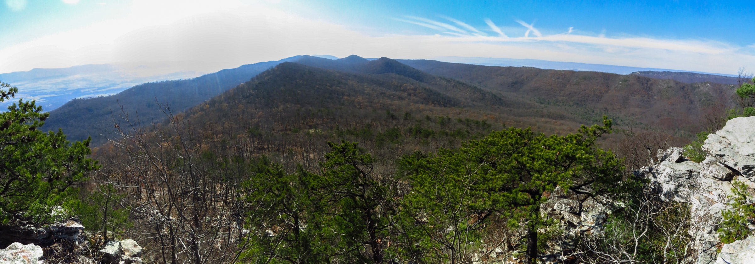
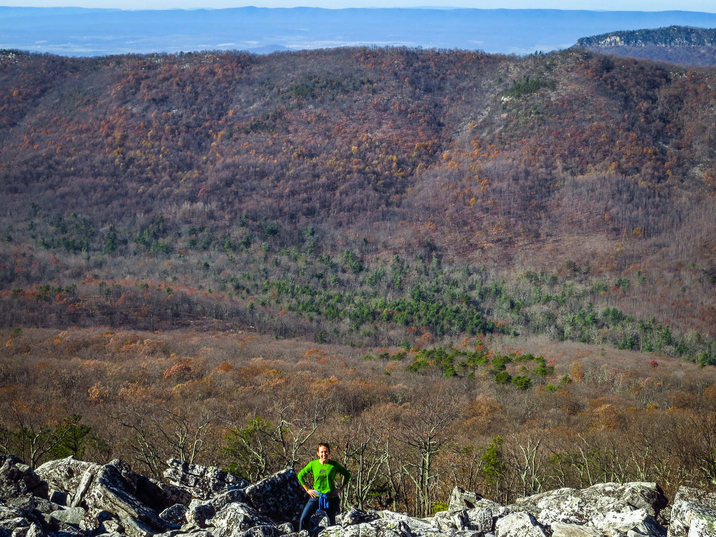
Turn right on blue-blazed Gap Creek Trail and ascent to Peach Orchard Gap. In the saddle, look for a trail off to the left. This is the Duncan Knob Trail, a 0.25 mile out-and-back to a large boulder field with a 180° panoramic view to the south.
After taking in the view, return to Peach Orchard Gap and take a left onto the blue-blazed Gap Creek Trail, descending 0.7 miles to the intersection with Massanutten Mountain Trail (you were here 7.5 miles ago). Take a left onto the orange-blazed Massanutten Mountain Trail and follow it 3.3 miles back to State Route 675. Cross the road and return to your car at Camp Roosevelt parking area.
Photos
Last updated June 16, 2020
What you do is up to you, but you shouldn't rely on these directions alone; they are often not specific enough to navigate by, and may be incorrect or out of date. Review a map beforehand and carry it with you. Tell a friend where you are going and when you plan to return. Do not count on having cell phone service while on the run. The VHTRC is not responsible for your welfare on any of these runs. If you go on one of these runs and get lost, run out of water, get injured, mauled by a bear, or die, or if anything else goes wrong, it's your fault; not ours. You assume all risks here and the VHTRC assumes none at all. Legal issues aside, some of these runs are more remote than others and the VHTRC is not suggesting that you do any of these runs, unless you are prepared to accept full responsibility for yourself.