Massanutten’s Revenge Report
by Joey Cohen
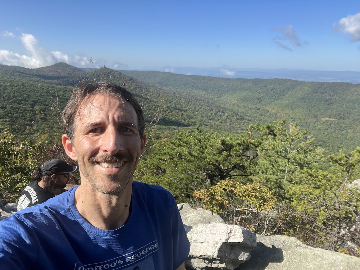
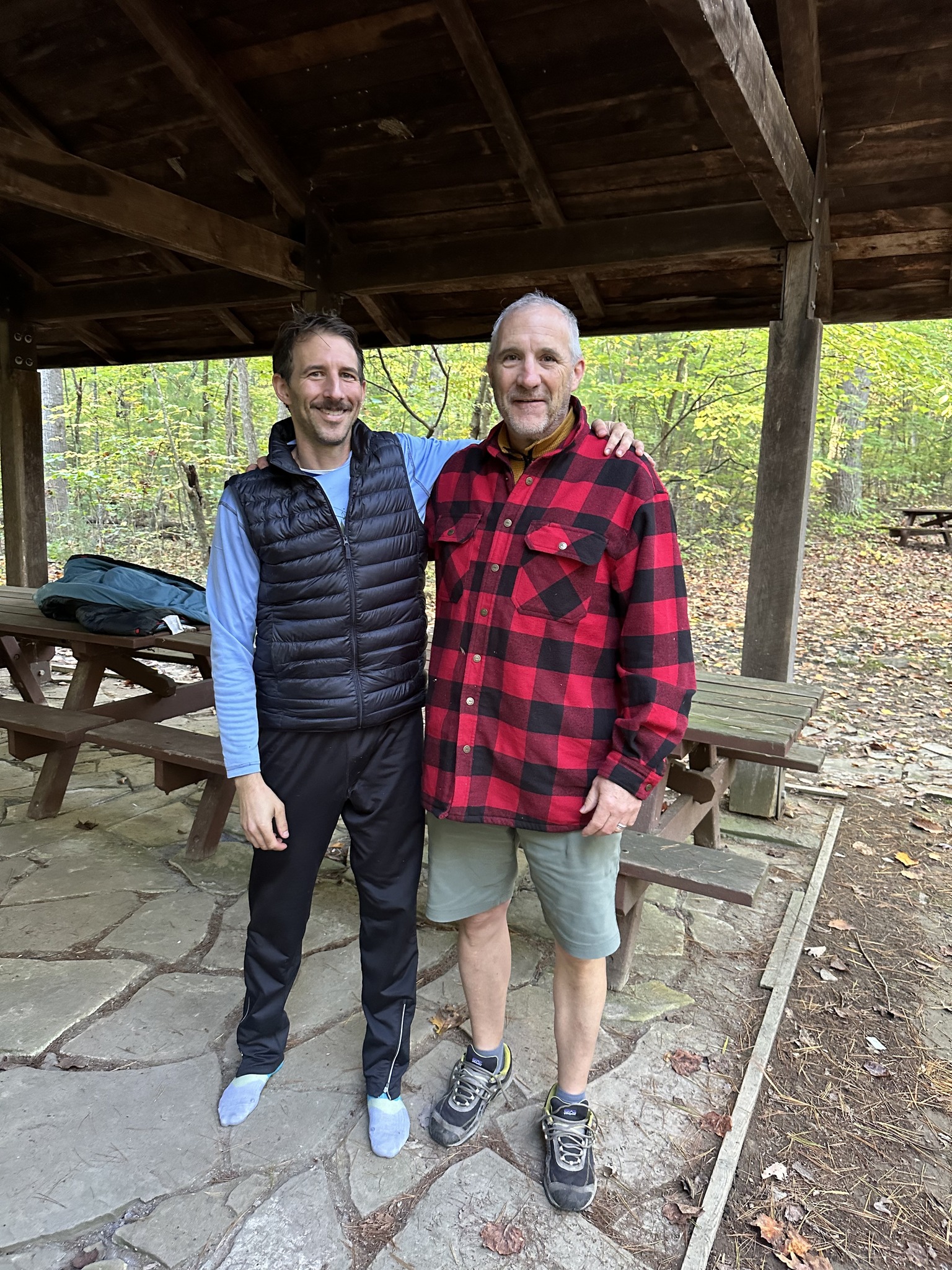
A Massanutten’s Revenge (“MR”) race report has to start with an acknowledgement of the volunteers that make an event like this possible. The runners in the 2024 edition of the race were far outnumbered by the volunteers, who dedicated a long weekend (or a substantial portion thereof) to support us on our journey through the mountains. A bunch of crazy ultrarunners helping a bunch of crazy ultrarunners enjoy this wacky sport we love so much. To Mario, Jeff, Chris, Brian, Hank, Tom, Nick, Heather, Barry, John, Charlene, and others I can’t remember (sorry, I’m writing this 10 months post race!), and of course the evil genius behind the race, Mike Bur, thank you. [Spoiler alert] I quite literally could not have finished this race without you. MR is the epitome of what makes the Virginia Happy Trails Running Club (“VHTRC”) so great.
Why Massanutten’s Revenge?
Massanutten’s Revenge is really hard. In the two runnings of the race prior to 2024, it had been attempted 15 times with just 3 finishes, the fastest being Luc Claessens’ 39:51 in 2023. Yes, 39 hours and 51 minutes. So why run it as my first hundred miler after a couple-year layoff, during which time my daughter was born and, to be honest, I hadn’t been doing much running? To answer that question, let’s rewind a bit.
In 2014 I was signed up to run Grindstone as my first 100. Training was going well until a month before the race, when I injured my knee. I was pretty much completely off my feet that whole month, so lining up for the race was out of the question. I was out long enough that I knew it would be wise do a bit of a reset, and do some shorter races first rather than to jump right back into another attempt at 100. So in 2015 I worked my way back up in race distances – a couple 50ks, a couple 50 milers, and, in September, the Ring – a 70-miler in the Massanuttens. 3 of the 5 were VHTRC fat asses. [In trail running, a “fat ass” is an informal race – “no fee, no awards, no complaining”.]
Though I still had my sights on a hundred miler, I had been reluctant to sign up for one – even back then, many races sold out well in advance of race day and I didn’t want to commit several hundred dollars to a race months before I’d know whether I’d be in shape to do it. So all through 2015 I had in the back of my mind the idea that, if the other races went well, I could sign up for the Wild Oak Trail 100 (“TWOT”) – a very difficult VHTRC fat ass – shortly before the race. To make a long story short, all five of the shorter races went really well, I hopped into TWOT just a few weeks beforehand, and that race went best of all.
Fast forward to 2022. My daughter was born in July and for the rest of that year I hardly ran at all, maybe 5 miles a week. Going into 2023 I was optimistic that as we settled into the whole parenting thing and got into more of a routine, I’d get my running mojo back and run another 100 towards the end of the year. With age and experience I’ve come to the conclusion that you can get in pretty good running shape on much less than the 60+ mile weeks I had run in my younger years. So I proposed a plan whereby I’d run twice a week, 20-ish miles total, and then try to add in a third run per week in the 6-8 weeks leading up to my goal race – the Grindstone 100 in October. With my wife’s blessing, I ponied up the several hundred dollars and Grindstone was on the calendar.
To make another long story short, things did not go to plan. In the first half of 2023 I was running a bit more than I had in 2022, but not much. I held out hope that I’d get my mileage up, but I just couldn’t get my act together and by September I realized that I wasn’t going to be in 100-mile shape by race day. So I pulled the plug on Grindstone. Again. Sad face.
But that same October that I should have been running Grindstone, a miracle appeared in my running life in the form of my new neighbor (and now friend) Jason. Jason ran track and cross country in college and is a much better runner than I’ll ever be. Though he’d replaced his running with biking after college, he was still in great shape. And, importantly, Jason has a son right around my daughter’s age and is similarly time constrained. So that October we started running together. Tuesdays at 9 pm. Rain or shine. Or snow or frigid temperatures, as the case may be.
There’s rarely a good excuse why you can’t run at 9 pm on a Tuesday, so with Jason’s help I finally found some consistency in my running life again. When we first started, our runs were maybe 5 or 6 miles, but we very gradually worked our way up to the point where we were doing 12 or 15 or more miles on our Tuesday night outings. When you’re running that much every Tuesday, it’s not hard to get in the 20+ mile weeks I’d been hoping for.
As we rolled into 2024, I started to feel a glimmer of my former running self and again considered the possibility of running a hundred miler. Once again I’d had to eat the Grindstone entry fee, and once again I was reluctant to shell out several hundred more dollars months prior to a “real” race. So I decided to do what I’d done in 2015 – run some shorter races and, if my training and the races went well enough, throw my hat in the ring for a fat ass hundred at the end of the year. I considered doing TWOT again, but decided instead on the relatively new (and seemingly more difficult) Massanutten’s Revenge.
Training
What my training lacked in mileage it made up for with consistency. In the first 40 weeks of 2024 leading up to MR, Jason and I ran 31 Tuesdays. I averaged just under 25 miles per week on just under 2 runs per week. I sprinkled in a few long runs / races along the way and just hoped it would be enough: the Forgotten 50k in Cleveland in May (put on by another ultrarunning neighbor of mine – our street is a hotbed of running talent!); the Highlands Sky 40 miler in West Virginia in June; and 25-mile training runs in Cuyahoga Valley National Park and the Laurel Highlands in the beginning of August and September, respectively.
These went just well enough that I thought MR might just be doable, so I signed up for the race right before doing my final long run, a planned 35-miler in Shenandoah National Park (with plenty of vert) while visiting our friends Kendall and Emily at their awesome cabin near the north end of the park, two weeks before race day. That run was going great until about 20 miles in, as I was bombing down the Keyser Run Fire Road, when my foot started hurting. Crap. I got to the bottom and assessed my options: 1) bail right there and call my wife to ask for a ride out (a couple-hour drive for her each way to rescue me); 2) hike the few miles up the Little Devils Stairs trail or back up Keyser Run Fire Road and call for a ride along Skyline Drive (a slightly shorter, but still quite long drive for her); or 3) finish on my own two feet. I thought that as long as I went slow enough, it wouldn’t make my foot any worse, so I chose option 3 and basically walked the last 15 miles, finishing what I expected to be a 7+ hour outing in 9+ hours.
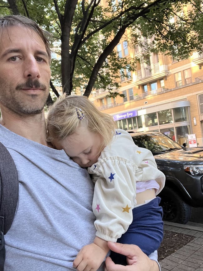
At that point I figured my chance of running the race was slim, but I stayed off my feet as much as possible and crossed my fingers that by race day my foot would be sufficiently healed to hold up for 100 miles. With literally no running for the next two weeks, back down to Virginia we went – me with my wife Sara and 2-year-old daughter Flora.
The Race
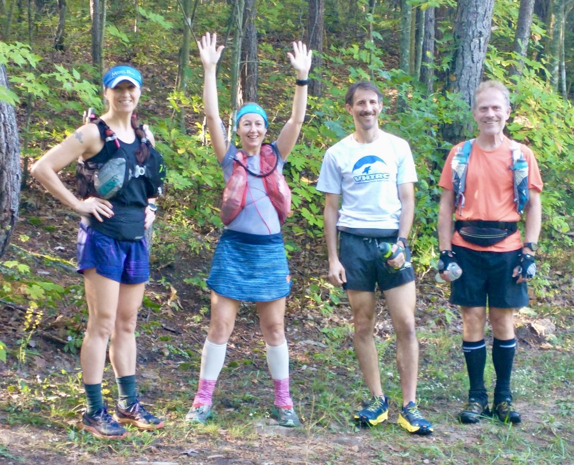
In the weeks leading up to the race, there were a dozen or so people signed up. By race week that had dwindled to six or seven, and by race day we were down to four: me, Samantha, Luc, and Jana. The fearsome foursome. Luc and Jana were two of the race’s three previous finishers, so they had a slightly better idea of what we were getting ourselves into. But MR is a decidedly “graduate level” race, and Bur will only let in people who understand the gravity of 100 miles in the Massanuttens and who have the experience to suggest they have a chance of finishing. So we were all ready for a long couple days in the mountains.
MR typically requires that all runners who have not previously finished the race have a crew for the second day. Unfortunately my planned crew/pacer had to bail at the last minute, so Sara and Flora would serve as my crew. Their availability, however, would be subject to the sleep/nap schedule of a 2-year-old, so they’d come to the aid stations when the could and would be available to come rescue me in case of an emergency. I told this to Bur, and he assured me it wouldn’t be a problem – with just four runners, the volunteers would be much better able to handle any drops. Because he was effectively waiving the crew requirement for me, I didn’t want to show any signs of weakness or otherwise indicate any increased likelihood of dropping, so I didn’t mention the whole foot thing to him.
Start to Habron Gap Aid Station (mi. 9.0)
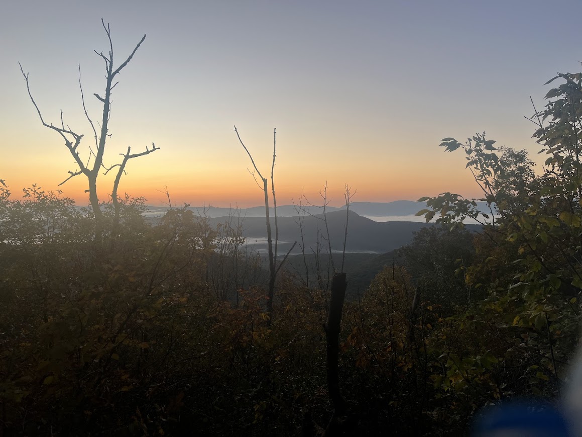
At 10 o’clock on Friday morning, the four of us lined up in the Stephens Trail horse trailer parking area of the Massanutten Mountains, ready to go. I got some incredulous looks when I showed up with just a small waistbelt and handheld bottles. Surely that wasn’t enough gear to get me through 100 miles! No, it wasn’t enough gear to get me through 100 miles. But the weather was absolutely perfect at the start, and the forecast showed that it was very, very unlikely to change in the few hours it would take me to get me to my next drop bag, which had warmer clothes, a raincoat, etc. If the forecast soured and it looked like I’d need any of those things later on, I could pick them up from a drop bag. I’d travel as light as I could for as long as it was safe to do so. A few pictures, some words of encouragement from Bur, a huggy kissy from Sara and Flora, and we were off.
As a general rule, everyone starts ultramarathons too fast, so I let Samantha, Luc, and Jana go ahead and I started the race in last place. I was in no hurry. Breathe in, breathe out. For a non-elite runner like me, these races are not about how fast you can run – they’re about how far you can go before you can’t run anymore and are slowed to a walk. My main objective was to make each footfall as gentle as possible and to move as smoothly and efficiently along the trail as I could. Breathe in, breathe out. About a half mile in I realized that in the excitement of the race start I’d forgotten to start recording my GPS track, so I pulled out my phone to do so. Strava or it didn’t happen.
Soon thereafter I caught up to Samantha and rode her wheel for a bit while we chatted about the race. Though I didn’t know her personally, she’s another dedicated VHTRC’er so I knew of her and knew she’s a strong mountain runner. Though I certainly enjoy my alone time on the trails, I knew I would likely have plenty of alone time ahead of me and it was nice to have the company of a kindred spirit for a little while. Before long I asked to slide past her and carried on along the trail alone.
A couple miles later I caught up to Jana and tagged along with her for a bit. Having finished MR before, Jana was able to offer some valuable course recon and we chatted about favorite races, parenthood, and more. We soon took a left turn onto the eponymous (and infamous) Massanutten Trail.
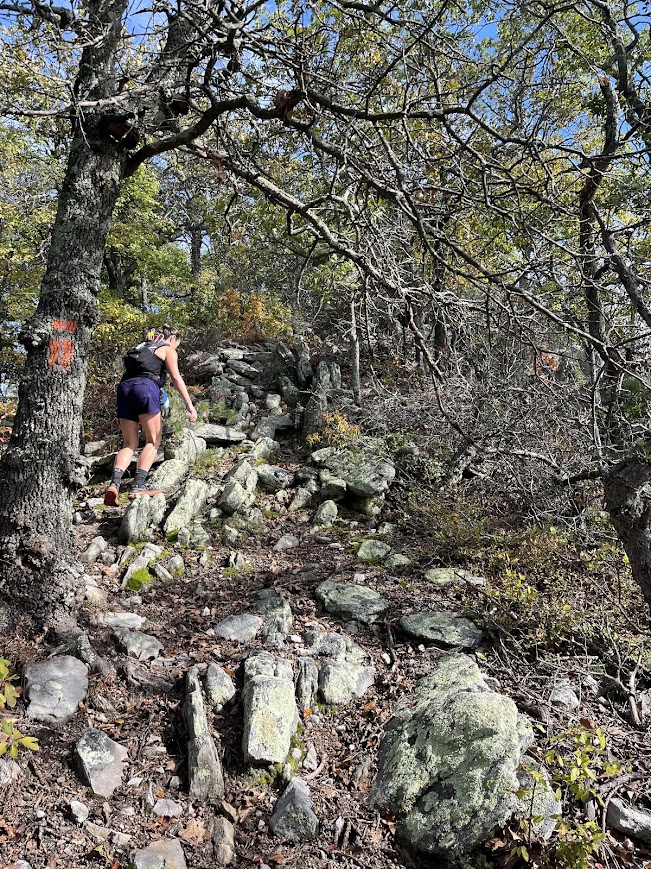
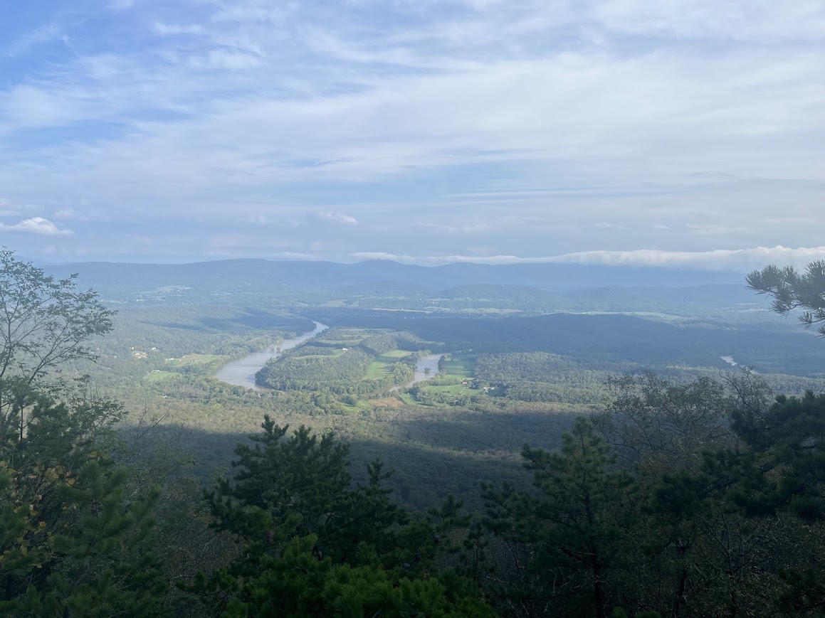
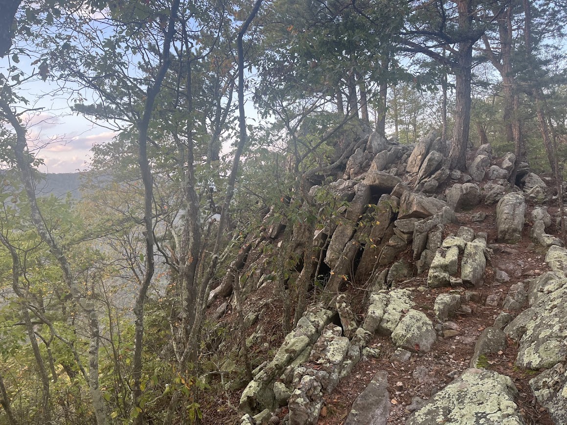
This trail is rocky, to say the least. A geologist can explain it better than me, but the geological forces that created these mountains were different than those that create most “cone”-shaped mountains. Look at the Massanuttens on a contour map and you can see that they’re different. The range is made up of two distinct ridge lines running north to south parallel to one another, and the Massanutten Trail is a 70-ish mile loop that traverses both the east and west ridges. The trail is marked with orange blazes, so hereinafter “orange” refers to the Massanutten Trail.
Masochists that we are, the VHTRC hosts many training runs in these mountains as well as a bunch of fat ass races, including The Ring, a clockwise circumnavigation of the full 70-mile loop; the Reverse Ring, a winter counter-clockwise running of the same; and a handful of “50k” (ie. 30-35 miles) races. It also hosts one “real” race, the Massanutten Mountain Trails 100 (or MMT), which covers most of the Massanutten Trail and otherwise consists mostly of country roads in the area. I’ve run the Ring, Reverse Ring, MMT, and a few of the 50ks, and every time I finish one I say to myself that I’m never running in the Massanuttens again. Until I sign up for the next one, of course.
Jana and I picked our way through the rocks of the Massanutten Trail until we eventually took a right turn onto the Habron Gap Trail and started down the ridge towards the first aid station. As the rockiness subsided a bit and the trail sloped downward, my objective of running as smoothly as possible required me to pick up the pace, so I passed Jana and continued on down the mountain.
As I rolled into the aid station (mile 9 of the race), Luc was just leaving. I had planned to start the race fueling mostly with the gels and chews I had on my person, so I refilled my water, took a couple cookies, and went on my merry way. I had arrived at the aid station in 2:07, a bit slower than the 2:00 I’d predicted, but putting splits together for a race like this is a very inexact science so I was basically on schedule.
The “course record” (again, of just 3 finishes so far) was the 39:51 that Luc had run the year before. The hundred milers I’d previously run ranged form 21+ hours to 33+ hours. These had included some of the toughest 100s around (on the east coast at least), and I’d run 22:15 at MMT, which covers much of the same ground as MR. Could MR possibly be so hard that it would take me 40 hours?
I knew I wasn’t in as good shape as I was when I ran MMT. And, where MR deviates from the MMT course it’s much more difficult. And, the MR course is actually around 108 miles. But, I audaciously thought I could beat Luc’s time. His splits for the first half of the race seemed slow, and his splits in the second half of the race seemed really slow. So I put together anticipated splits that roughly mirrored Luc’s splits for the first half and then sped up a good bit (compared to Luc’s splits) for the second half, for a 36-hour finish. And, if I’m being completely honest, I thought that a couple hours faster than that wasn’t completely out of the question.
Habron Gap Aid Station to Veach West Aid Station (mi. 21.2)
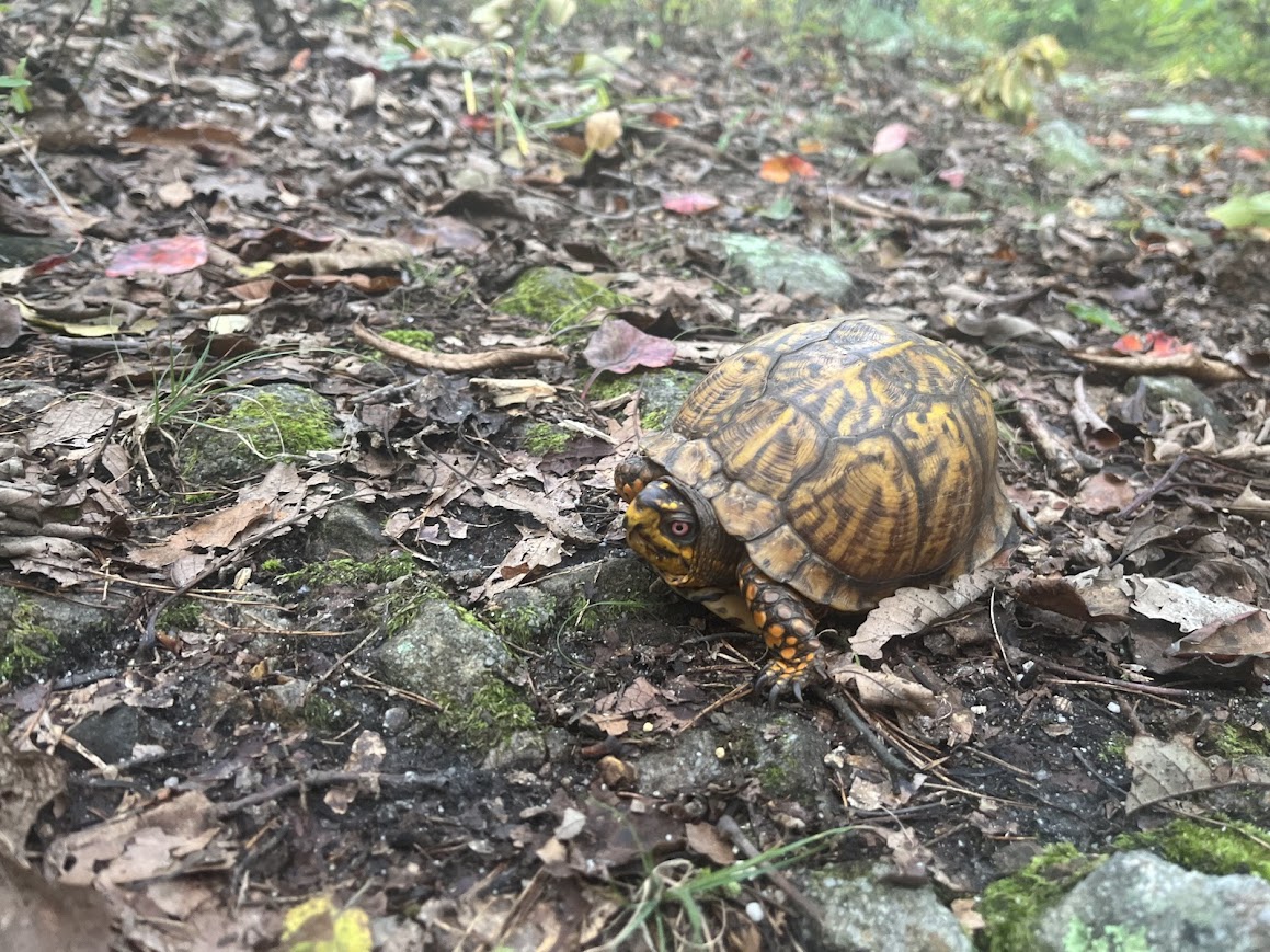
Back up the Habron Gap Trail I went, pretty much on target and on Luc’s tail. I caught a few glimpses of him as we neared the top. Shortly after turning right onto orange I passed a friendly turtle along the trail, and soon thereafter I caught up to Luc. As soft-spoken of a guy as I am, Luc might be even more soft spoken, so we didn’t make much conversation. But staying upright while running in the Massanuttens requires one’s full concentration so that may have been for the best. We cruised along the Massanutten Trail together for a while until I asked to pass, taking the lead as I did so.
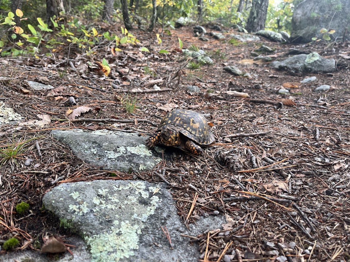
I continued up orange, passing another friendly turtle right on the trail, until I turned onto the Veach Gap Trail and down to the Veach West aid station, around mile 21. The stretch from Habron to Veach had taken me 3:20, again a bit longer than my estimated split of 3:05, but within the ballpark of what I’d expected. Veach West was the first crew-accessible aid station, meaning Sara and Flora were welcome to meet me there, but I was arriving just as Flora was waking up from her nap at the Airbnb 45 minutes away, so I’d have to wait until the next morning to see them (at the earliest). Sara and I were texting throughout the race to coordinate, which is an indication of the fact that, while it was a “race”, with only three competitors and an expected finish time of a day and a half, I wasn’t always in the biggest hurry.
Veach West Aid Station to Buzzard Rock Aid Station (mi. 31.4)
This time I was leaving the aid station just as Luc was arriving. Back up Veach and a left back onto orange, following the rocky ridge north towards to Shawl Gap.
At Shawl Gap, instead of staying on the Massanutten Trail towards Elizabeth Furnace, we turned onto the Buzzard Rock Trail, a part of the course I had not previously run. This trail was, amazingly, even rockier than the Massanutten Trail, but I kept on keeping on, still focusing on traveling as smoothly as possible. At some point on the stretch, as afternoon turned to evening, having not yet covered a third of the course and realizing that once it got dark I’d be going even slower, it became clearer just what an undertaking this event would be.
I reached the Buzzard Rock aid station (mile 31) having covered that 10 mile stretch in 3:12, a bit slower than my 3:00 estimate. Though each of my splits had been slower than what I’d predicted, I was still feeling pretty good and figured I’d have ample opportunity to make up time in the latter half the race.
Buzzard Rock Aid Station to Elizabeth Furnace Aid Station (mi. 37.5)
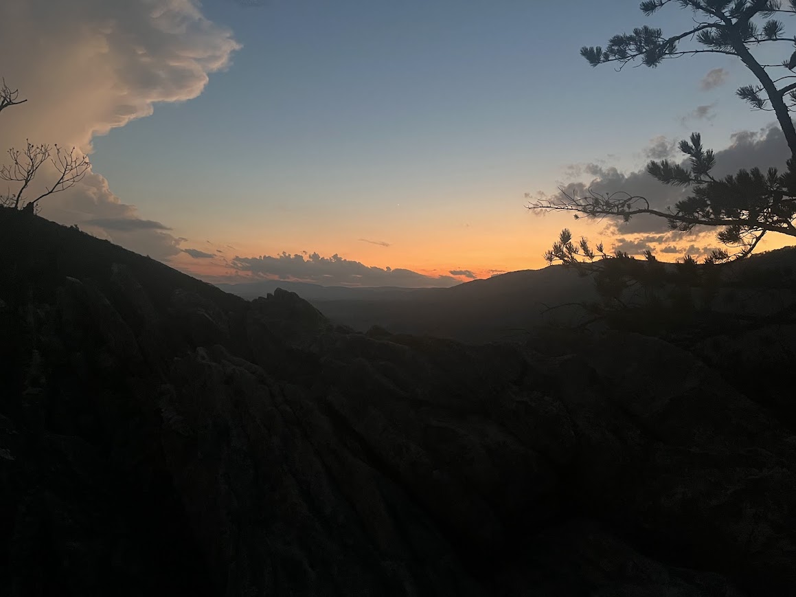
From the aid station we retraced our steps back up the Buzzard Rock Trail. I enjoyed a beautiful golden hour as I made way up the steep climb, and by the time I reached Shawl Gap again day had turned to night. There we turned right on orange to take the Massanutten Trail down into the valley between the east and west ridges and to the Elizabeth Furnace Aid Station. This part of the course is also part of the Elizabeth Furnace 50k course, which I’ve run three times, so it was nice to be on trails that I was relatively familiar with. I don’t recall exactly why, but I remember having a bit of a low point along this stretch. Maybe because I was trudging along in the dark and I realized that I had many hours of the same ahead of me. It’s easier to feel optimistic when the sun’s out.
I reached the Elizabeth Furnace aid station (mile 37.5) in 10:50 elapsed, having covered that six mile stretch in 2:11, just a bit slower than the 1:55 I’d estimated, yada yada yada, you know the story.
Aid stations have a much different vibe at night. When everything outside the tent is dark, and you’re out there in the woods with these people who have driven a long way and stayed up all night for you, and they’re giving you food and encouragement, knowing that they’re about to send you back out into the dark lonely mountains, you can feel a weird closeness to the volunteers in that short (or long, as the case may unfortunately be) time that you’re out there together. That was especially true for this race. My memories of the aid stations take up a disproportionate share of my memories of the race. Thank you again to all of the volunteers for being out there.
Elizabeth Furnace Aid Station to Woodstock Aid Station (mi. 50.1)
It’s a long 12.6 miles from Elizabeth Furnace to the next aid station at Woodstock Tower. First there’s a 4.5 mile climb on the Tuscarora Trail up to the west ridge. It’s technical, as the trails in the Massanuttens tend to be, but nothing too terrible. Then, instead of turning south on the Massanutten Trail (which follows a fire road for a few miles) as you do in MMT, you stay on the Tuscarora Trail for 3.5 miles, following the ridgeline south over Three Top Mountain.
The trails on our public lands exist because of the hard work put in by many people, mostly volunteers, to build and maintain them. Over time, trees fall across the trail, trails erode, blazes fade. Without regular maintenance, trails become much harder to follow. The Tuscarora Trail over Three Top Mountain has not been maintained in years.
In one of his pre-race emails Bur recommended that, if you do a training run on the course, do this section of the course. When I came down to Virginia to do the long training run two weeks before the race I considered heeding this advice, but decided instead to do the run in my beloved Shenandoah National Park. I’m glad I did, because if that training run had included the Tuscarora Trail over Three Top Mountain, I don’t think I would have come back for the race.
If the trunk of a tree falls across a trail, it slows you down a bit as you climb over or crawl under it. But if the top of a large tree falls across the trail, that’s a whole different story. The trail becomes a tangled maze of branches. You could try going around the tree altogether, but the crowns of these trees are huge, and you may have to go pretty far off the trail to do so. And as technical as the trails are in the Massanuttens, the off-trail terrain is even more technical. So most of the time you just do your best to pick your way through the maze and hope that when you come out the other side you’re somewhat near the trail. And remember, I was doing all of this in the dark, having already covered almost 50 miles in 14 hours. Thank goodness for GPS, because along this stretch I kept finding myself of course, lost among the rocks and trees. Even if you’re just a few feet off the trail, it can be hard to see where the trail is.
As I said earlier, the past runners’ splits for the second half of the race had seemed impossibly slow. The fastest splits for this section were a bit under 20 minutes per mile. The slowest were over 30 minutes per mile. “How could people be running so slow?” I thought. The answer is that for much of this stretch you’re not running. You’re not even hiking. You’re stuck in the middle of some tree that fell across the trail, questioning your life decisions.
Let’s not dwell on that any longer. Eventually I made it over Three Top Mountain and hopped back on the Massanutten Trail for an “easy” 4.5 more miles to the Woodstock Tower aid station. The 12.6 miles from Elizabeth Furnace took me just shy of five hours, versus my expected 4:15.
When I got to the aid station, I was very glad to finally take a seat and be pampered by the volunteers. There I was, out in the wilderness at 2 o’clock in the morning, being fed miso ginger soup and other delicacies. They were doing this all for just the four of us runners. I would later learn that Luc, because of allergies that he had developed following a tick bite, was fueling himself on just the sports drink he had brought with him, so he was running basically unsupported for the whole race. So the volunteers were really doing all of this for just three runners. (As an aside, Luc’s ability to do this race without taking any of the aid station food blows my mind. That food – my literal fuel for the race – saved me out there. I cannot imagine having finished the race without this support.)
I pride myself on typically being very efficient in the aid stations and not wasting too much time in them, but I really lingered in this aid station. I’d already spent many hours out there alone, with many more to come. And having not seen another runner for close to 40 miles, it was tough to motivate myself to hurry out. So I spent way too much time there, about 20 minutes. I’m not saying I should have sped through in 2 minutes, but I probably could have gotten just as much benefit from stopping for 15 or even 10 minutes. But eventually I had to pick myself up and start moving again. Those next fifty miles aren’t going to run themselves. Or should I say those next fifty-eight miles. The course is about 108 miles, so despite having crossed the fifty mile mark, I knew I still hadn’t reach the halfway point. Another one of Massanutten Revenge’s cruel tricks.
Woodstock Tower to Edinburg Gap (mi. 58.3)
This section is simple. A little over 8 miles, straight down the Massanutten Trail. One foot in front of the other. The only problem was that it was now getting to 3, 4 o’clock in the morning, and I was getting sleepy. I’d tried my best to catch up on sleep in the days leading up to the race, but that’s not easy with a 2 year old. I was lucky to have Sara and Flora along for the drive down to Virginia the day before, because while Sara was driving I was so sleepy that I just had to take a nap. That was a sure sign that I was not as caught up on sleep as I needed to be.
So as I trudged along down the trail I made a plan to get to the next aid station, eat a bunch of food quickly, and then take a little nap while I digested. But I soon realized that the plan wasn’t going to work. I was just too sleepy.
Deciding whether to sleep during a race can be a tricky calculus. Does the benefit of the sleep outweigh the cost of not making any forward progress while you’re laying down? I think a big factor in that is how fast you actually fall asleep. If you’re not going to fall asleep quickly, and are instead spending time just laying on the ground uncomfortably, it’s probably not worth it. But I knew that once I closed my eyes, I’d be out immediately. So I set a timer on my phone for 10 minutes, laid right down in the middle of the trail, pointed my water bottle in the direction I was traveling (so I wouldn’t wake up and start going the wrong way), and closed my eyes. As expected, I was out immediately.
When my alarm went off, I indulged myself with just one snooze. And closed my eyes again. The next thing I hear is not my alarm, but the most gentle voice you’ve ever hard speaking to me: “Are you okay?”
I was startled awake, not expecting to encounter another person at this time and place, but it quickly registered that this was Luc. Though we hadn’t crossed paths for many miles, he had never been too far behind. My long aid station stop and the nap had allowed him to catch up. I quickly assured him that I was totally fine, just a little sleepy, and popped right up to start moving again. This was a race after all! Onward we went. I was able to get just a small gap on Luc and arrived at the aid station three minutes before him. With the long stop at the previous aid station and the nap that section had taken me 3:27, again quite a bit longer than my 36-hour split of 2:45. I was losing more and more ground on that goal time, but that goal was quite a bit faster than the 39:51 course record. Even if I wasn’t going to make that 36 hour goal, beating Luc’s time from the previous year was still well within reach.
Edinburg Gap was another oasis in the desert. Again the food was life-saving and again I spent too much time, close to 20 minutes. But at least we were past the half way mark! (In terms of distance at least.)
Edinburg Gap to Gap Creek I (mi. 68.9)
Nothing too remarkable here. We were treated to a gorgeous sunrise, and after slogging through a long night I felt completely awake and refreshed in the daylight. The most notable thing about this section was the excitement that, with an expected arrival time at the next aid station around 9 am, Sara and Flora were going to meet me there!
I can so vividly remember Flora shouting “Daddy!” as I rounded a corner and came into view of the aid station. I’m quite sure that at no other time on the race course was I smiling as much as I was at that moment. [For those taking notes at home, I finished that section in 4:25, a half hour slower than my 3:55 expected.]
This was the first hundred miler Sara or Flora had ever been to, and I’m glad that this particular hundred miler was their first. Running 100 miles through the mountains can sounds a bit perilous, but I think that seeing Bur, Brian, Mario, and others out there supporting us made them feel more at ease. We were truly in good hands. And they were so kind and helpful to Sara and Flora, who may have felt a bit out of their element out there.
As I took a chair to eat some food and regroup, Flora was happily helping herself to some grapes from the aid station spread. I’d later learn that Samantha had dropped around the half way point, and with Luc eschewing the aid station fare there was way more food than the two remaining runners could eat.
Seeing me having just run almost 70 miles was also a new experience for Sara and Flora. Sara later told me that when Bur mentioned that he would be making breakfast sandwich for the runners, she thought there was no way I’d eat one – she typically just sees me with gels, chews, and almond butter packets on my runs, not breakfast sandwiches! While those things might be suitable for a 10- or 20- or even 30-mile run, if you’re running 100 miles they just won’t cut it. So Sara was surprised to see me scarf that breakfast sandwich.
Flora was a very capable crew chief and helped me change my socks and otherwise gear up for the next section, another long 12.5 miles to the Picnic Area aid station. If I was tempted to linger at the previous aid stations, I was much more tempted to linger here and enjoy Sara and Flora’s company. But I still had a (very) long way to go, so after another 20-ish minutes I was on my way.
Gap Creek I to Picnic Area I (mi. 81.4)
From the Gap Creek aid station you cross the creek over a little foot bridge, then start climbing. You keep climbing until you reach the turn-off to the Duncan Knob Trail, and then climb to the top of Duncan Knob. Race rules required runners to take a selfie at the top to prove you went the whole way. I had never climbed Duncan Knob, so I didn’t know what to expect. Or to say it better, I didn’t even think to expect anything different than just an ordinary (if rocky) trail to the top.
Duncan Knob is just a massive pile of rocks. Some are the size of basketballs, some are the size of cars. There is no trail. There are no blazes to show you the “right” way to go. When I got to this massive pile of rocks I was confused. There were a couple other hikers there that were similarly confused. I kept looking at the GPS on my phone, which showed that I was in the right place, but it seemed inconceivable that the right way to go was just to scramble up the rocks. It seemed dangerous, but perhaps that sense of danger was heightened by the fact that I’d already traveled over 70 miles and had only slept 20 minutes the night before.
Eventually those two hikers and I resigned ourselves to the fact that the right way was just a semi-dangerous scramble to the top. I kept taking my phone out to see if I was on the right track, but it was annoying to do so since I needed the use of my hands to help me climb safely. Slowly but surely we made it to the top. It took me 20 minutes to climb about a third of a mile.
A quick selfie and I was on my way back down. There were a few other hikers at the top, and I think they were bewildered by my hasty exit. Surely not many people do that climb and then only stay at the top for a few seconds.
On my way back down I decided to ignore the “correct” route in the GPS file, and just freestyle it down. It was impossible to stay exactly on that track and I didn’t think doing so was necessarily an easier route than whatever would come naturally to me. This turned out to be a foolish decision, as my freestyle descent took me quite a bit out of the way and it took me even longer to go down than it did to go up. But I was glad to have this portion of the course behind me.
Back down the Gap Creek Trail and a right turn onto orange. Then you have a steep, rocky climb followed by a steep rocky descent, and then an even steeper, rockier climb up Waterfall Mountain. At the top, about 8 miles into the 12.5 stretch between aid stations, there would be a water drop. That 12.5 mile stretch had taken the previous years’ racers 5 to 7+ hours, so having access to fresh water along the way would be a big help.
The original race course called for that water drop to be right at the road crossing at the top of the climb. But on race day Bur informed us that they would instead stash the water drop farther up the trail, in order to prevent day hikers from tampering with it. It would be about a six to eight minute hike up from the road crossing, I think he might have said. After crossing the road and hiking what seemed like far enough I still didn’t see the water. I couldn’t imagine the volunteers lugging the water any farther up the trail. I was way out of sight of the road. So I backtracked. Maybe they had stashed the water near the road after all? I searched and searched, but still no sign of it.
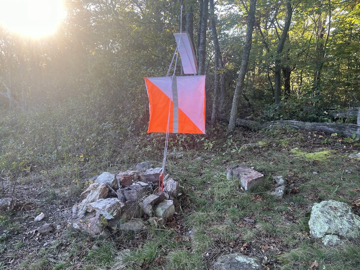
At several point along the course, Bur had placed orienteering punches: large orange reflective things, attached to which there was a special hole puncher – punch your bib to show that you covered that part of the course. The water should have been stashed with one of those orienteering punches, so even if the water itself was hard to see, the blaze orange of the orienteering punch should be easy to see in the woods.
After about 15 minutes of searching, I decided to press on, my water bottles close to empty since I was expecting to find water there. I’d tell Bur what happened at the next aid station. Back down Waterfall. Along the way I passed Luc, who was having a rough patch and was considering dropping. If he were truly intent on dropping, he would have bypassed that out-and-back up and down Waterfall and continued straight on to the aid station, so he must have thought there was at least a chance he’d be able to finish this thing out. I wished him well and continued on down Waterfall until turning right on the white-blazed MMT connector trail.
This was easily the most runnable portion of the course. It was mostly an abandoned gravel road that was overgrown with vegetation. Running through the dew-covered tall grasses felt refreshing on my legs. The only problem was that occasionally mixed in with those tall grasses were thorny vines. I could have avoided them by walking along the trail and carefully stepping over the vines, but having the opportunity to finally run a little while was too hard to pass up so I just ran straight through them, scratching up my legs quite a bit in the process.
Eventually I crossed Rt. 211 and picked up the Massanutten Trail for another couple miles until reaching the Picnic Area aid station. With the slowdowns on Duncan Knob and Waterfall, the 12.5 miles took me 5:39, a full hour slower than I’d predicted. It was becoming more clear why this course was so slow.
I explained to Bur how I couldn’t find the water drop or orienteering punch at the top of Waterfall, and we determined (after looking at my GPS track) that I simply hadn’t followed the trail far enough away from the road to find it. I had forgotten his tip that the water stashed where the trail takes a hard right turn. I had come about 100 yards short of that turn. “Thankfully” the course climbs Waterfall twice, so Bur said that as long as I got the punch the second time through, I was in the clear.
The Picnic Area aid station is crew-accessible, but I arrived during early-afternoon nap time, so my crew wasn’t able to make it. But Bur, Brian, and Mario are as good a as crew a runner could ever ask for, and fueled me up for the 10-mile loop on the southern end of the course – up and over Bird Knob before returning back to the Picnic Area for the second time.
Picnic Area I to Picnic Area II (mi. 91.3)
I left the aid station, over 80 miles in, feeling pretty good. I was moving slow enough and fueling well enough that my legs were still in decent shape. The afternoon was warm and sunny, and the trails on this section of the course weren’t too rocky (by Massanutten standards at least). I finally found that elusive flow – my body floated up the trail seemingly effortlessly; I felt like I could keep going forever. As I passed a couple day hikers on the long climb up to Bird Knob, I was amused by the thought that they would never have guessed that I had been moving since 10 o’clock in the morning the previous day.
Sara and Flora had missed Picnic Area I because of nap time, and if I didn’t hustle I wouldn’t make it back there long enough before bed time for them to see me pass through the second time. So I was more motivated to move quickly on that section than at any point earlier in the course. And I was already 90 miles in! The end was in sight! Let’s do this!
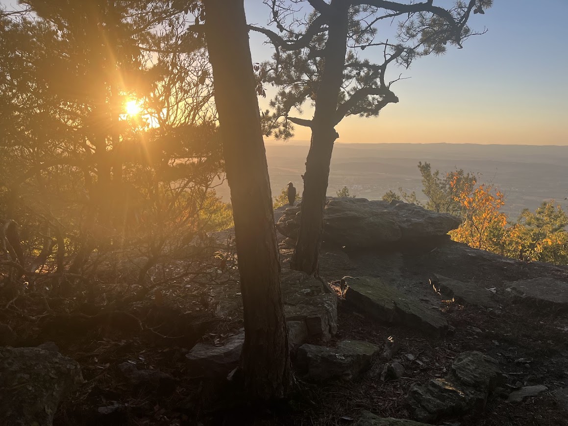
I reached the top of the Knob during golden hour, and took a moment to take in the setting sun with a friendly vulture. But then it was all business down to the aid station, where Sara and Flora would hopefully be waiting. The trail back down was rockier than I remembered it to be, but I made the most of the waning minutes of daylight and found myself back at Picnic Area a little before sunset. That 10-mile loop took me 3:33, twelve minutes faster than my predicted 3:45 split!!!!
Sara and Flora greeted me excitedly at the aid station and I once again filled up on the delicious food they had to offer. It being dinner time, the volunteers happily shared the food with Flora too. (As it turned out Jana had dropped at Gap Creek I, so with Samantha already out and Luc not eating the aid station food, there was plenty of food to share.)
Once again, Flora helped me gear up for the next long stretch – 10.4 difficult miles back to Gap Creek II. Just as it turned dark, I left the aid station and ventured out into the second night.
Picnic Area II to Gap Creek II (mi. 101.7)
After finishing up that southern loop I left Picnic Area retracing the steps I’d taken to reach it the first time. Down to Rt. 211 then up the Massanutten Connector Trail. This trail had seemed straightforward during the day, but at night I was having trouble staying on course. Once again I kept having to pull out my phone to orient myself and get myself back on track. Finally I made it back to the Massanutten Trail proper for the second climb of the day up Waterfall. The climbs and descents on this course are relentless. One foot in front of the other, up the trail.
Bur and Brian were waiting for me at the road crossing. Luc had dropped at Picnic Area, so I was the last runner on the course. They were there to retrieve the water drop and orienteering punch after I passed through. This is a grueling race for the runners, but also a grueling race for the volunteers. Bur and Brian were also into their second (mostly) sleepless night supporting the runners. Now they were just supporting me.
The reflective orienteering punch was easy to find in the dark (I suspect that if it had been dark the first time I climbed Waterfall I would have been close enough to see it). Bur and Brian were tagging along behind me, and after punching my bib they wished me well as I continued along the Massanutten Trail over Kerns Mountain.
Of all the rocky parts of the Massanutten Trail, Kerns is probably the worst. It must have been a while since trail maintainers had last passed through, since there were plenty of blowdowns to deal with. So it was slow going. And it was now the second night of the race (after getting just 20 minutes of sleep the first night), and I was getting sleepy. Very sleepy. The sleepiness was slowing me down so much that I had to stop for a nap. I managed to find a spot on the trail that I could lay down on without being directly on top of a big rock (not an easy task), set my alarm for ten minutes, and was out cold the second I closed my eyes. After the alarm went off I treated myself to one more 10-minute snooze, then back along the trail.
More slow going. An hour later I was just as sleepy as I’d been before, and just had to close my eyes again. But this time it was even harder to find a spot that wasn’t too rocky to lay down on. So I trudged along looking for a 2’ x 5’ stretch of dirt to curl up on. At last, I found it. The perfect spot. A patch of dirt just big enough for my body on the leeward side of a large rock outcropping. This was the Ritz Carlton of the Massanuttens. I had never been so happy. Set my alarm for 10 minutes again, and I was out. Followed by another indulgent 10-minute snooze.
When I woke up and looked at the clock I realized just how slowly I’d been going. Since leaving Bur and Brian at the water drop, I’d travelled a little over three miles in 2 and a half hours. I thought about texting Bur to explain that I was slowed down by a couple naps and the technical trail, but I was otherwise feeling fine and he shouldn’t be concerned. But I figured whether I texted him or not he’d be doing the same thing. Sitting at the next aid station waiting patiently for me to arrive. So I put my phone away and continued on, one foot in front of the other.
At long last I arrived at the Gap Creek aid station for the second time, arriving in 38:20 elapsed. That 10.5 mile stretch took about five and a half hours, well over an hour slower than I expected. Luc may have dropped, but his course record from the previous year would stand for at least one more year.
Gap Creek II to the Finish (mi. 107.8)
With only six miles remaining, the finish line felt so close. Bur and Brian got me fueled up and ready to tackle the last section of the course. The only problem was that I hadn’t planned my electronic device charging needs correctly, and now having been going for almost 40 hours my chargers were dead and my phone’s battery was dwindling. I wasn’t sure whether it would last to the finish. I had been relying on it to some extent to keep myself on course, especially in the dark, and was worried about getting lost. Fortunately, about three of those last six miles were on the Gap Creek trail, which I had run earlier that day, so at least I was familiar with that portion. (And this time I didn’t have to do the out-and-back to the top of Duncan Knob!)
So off I went into the darkness, very much looking forward to finally being done. Across the footbridge over Gap Creek and up the trail. I followed the trail up for a while, then followed the trail back downhill, over the footbridge, and … Oh crap. A half hour after leaving the Gap Creek aid station I found myself back at the Gap Creek aid station. I had gotten turned around about six tenths of a mile up the trail. That was demoralizing. Now I was certain my phone’s battery wouldn’t make it until the finish.
For the first time in the race, I considered dropping. Before the race I had promised myself I wouldn’t do anything excessively risky. I had gotten myself lost with my phone (on a portion of the course I’d run before), so there was definitely a chance I’d get lost in those last few miles I hadn’t covered yet. I considered using those last few percent of phone battery to call Bur to come back to Gap Creek and give me a ride to the finish.
But Bur, Brian, and all those other volunteers had put in so much time and effort to help me get to the finish. They were truly on my team. And we had come so far that I couldn’t just give up at this point. So once again, back over the footbridge and up the trail. If I got lost I could wait until sunrise to figure out how to extract myself.
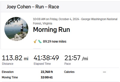
I successfully made it across the Gap Creek Trail and took the final left turn onto orange. From there it was a straight shot to the finish. Sure enough, my phone died on that final stretch, with a little more than a mile to go. There was one tricky turn on final stretch, when I could see the volunteers’ fire burning in the distance with a fire road leading seemingly straight to it, but you have to take the trail that veers to the right. Thankfully Brian and Bur had warned me about that turn at Gap Creek and I managed to stay on course and reached the finish line a little after 4 o’clock in the morning at 42:06 elapsed.
Bur, Brian, Mario, and Jeff were there to cheer me in. It had been a long couple days for all of us. I put on all of the warm clothes I had in my drop bags and promptly fell asleep on top of a picnic table.
Post Race
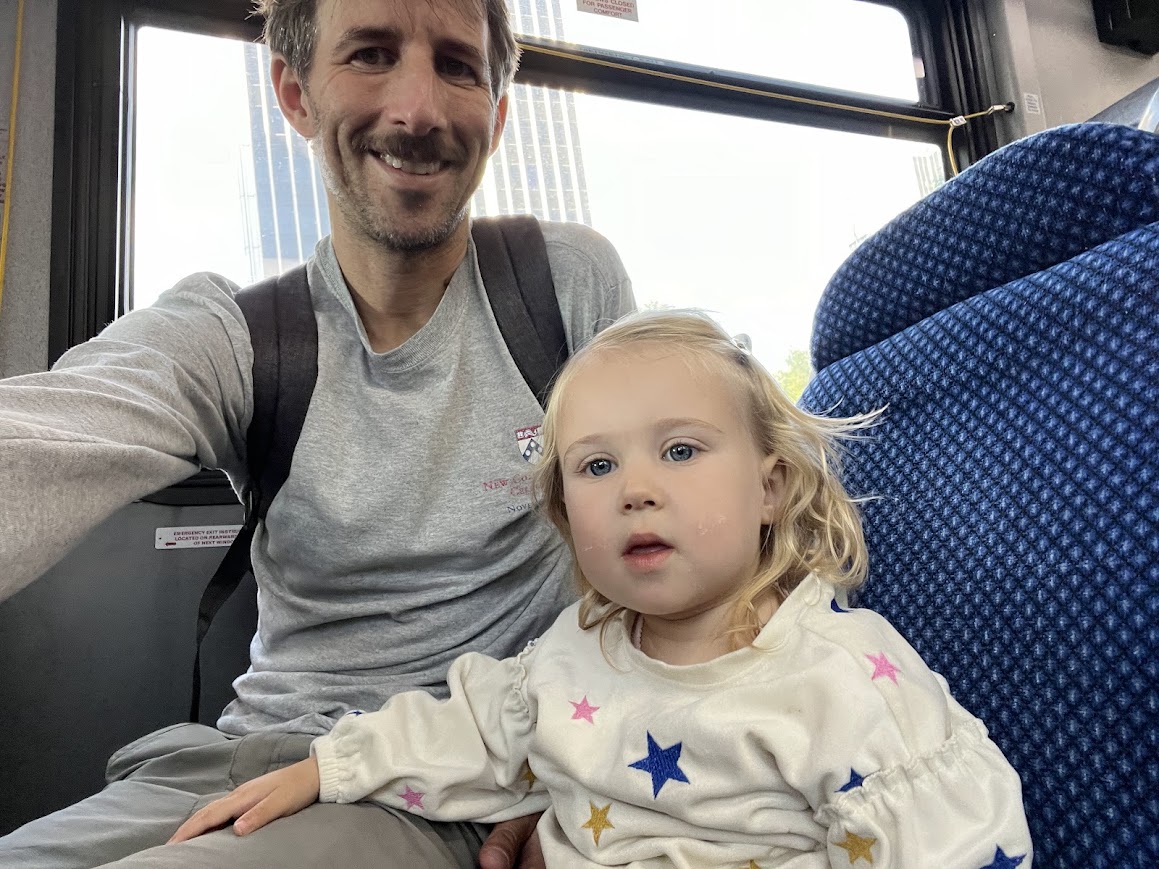
When we woke up, Mario prepared the most delicious breakfast I’d ever eaten. My phone was dead, but there wasn’t phone service at the finish area anyway, so I had no way to tell Sara I had finished. The text I had sent her from Gap Creek also hadn’t gone through, so she hadn’t heard anything from me since I’d left Picnic Area the evening before. Sorry to worry you, Sara! She and Flora came to the finish line after they woke up as planned, unsure if they’d find me there, and they were so happy to learn that I’d finished.
We all had real life to get back to, so we thanked the volunteers profusely, threw my drop bags in the back of the car, and drove off. We were in a bit of a hurry, as we had to get back to our Airbnb to check out by 10 am. Amazingly, my legs felt pretty much fine, and I had no problem going up and down the Airbnb’s staircase a handful of times to load our bags into the car.
Sara had to attend a work conference in DC on Monday, so we off we went, with a stop in Sperryville for another breakfast. Then into DC, where we met up with some friends who have a daughter a little younger than Flora. Then we met up with my aunt, uncle, and cousin for dinner.
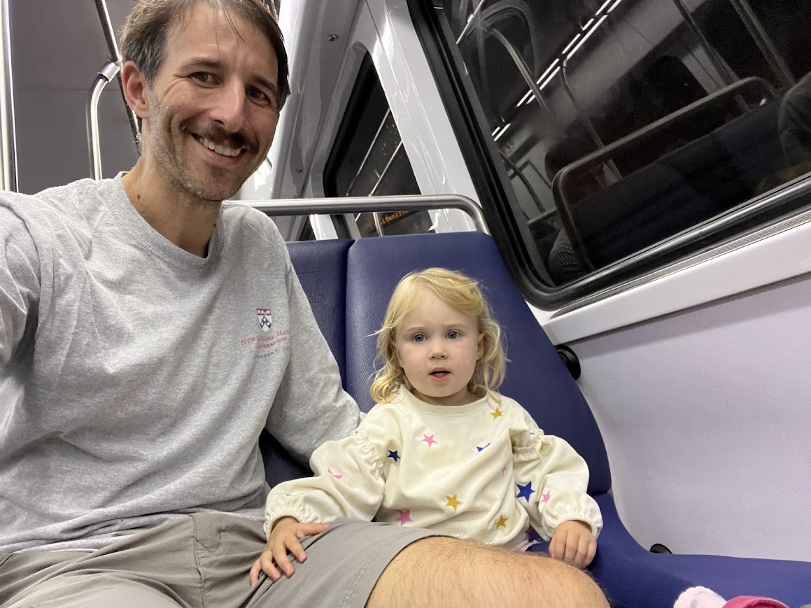
On Monday, while Sara was at the conference, Flora and I spent some time with my aunt and uncle and explored DC.
We picked Sara up in the afternoon then drove straight back to Cleveland. Back to work on Tuesday (where, I promise, I was very productive).
Additional thoughts
Why the heck did this race take so long? I ran MMT in 22:15, and the majority of the MR course covers the same trails. The main reason is that MR subtracts the very fastest portions of the MMT course – mostly roads – and replaces them with the slowest trails you can possible find – Buzzard Rock, the unmaintained Three Top Mountain, the pile of rocks that is Duncan Knob, and the worst of the worst of the Massanutten Trail, Kerns Mountain.
And, much of those really difficult parts of the course are run at night. As a general rule, the more technical a trail is, the more the darkness will slow you down. Darkness will only slow you down a little bit on a road, but will slow you down a lot when your picking your way through rocks and or scrambling through a thicket of branches. You pass through some of the toughest parts of the MR course at night, so the darkness slows you down a lot. And if you don’t finish Massanutten’s Revenge in under 33 or 34 hours, then you’ll be going into a second night. So sleep deprivation and the effect of the darkness is magnified.
Another factor is that the race field is very small, so it doesn’t have that same race feel as when there are more runners on the course. You really have to stay focused on moving as quickly as you efficiently can, especially on the really hard parts of the course. Losing that focus while running on a road might mean slowing down from 10 minute mile pace to 11 minute mile pace. But losing that focus while climbing Duncan Knob or Three Top Mountain might mean slowing down from 20 minute mile pace to 30 minute mile pace or slower.
Then there’s the aid stations. I spent way too much time at the aid stations. From Woodstock Tower onward, I was spending about 20 minutes at each one. Though it was wise to change my socks a few times and eat plenty of food, I probably could have cut those down to closer to 10 minutes without sacrificing too much recovery. Compare my total elapsed time below to the total moving time. Not all of that difference is from the aid stations (a lot of it must have been from times I was moving so slowly that the GPS considered me “not moving”). But clearly I could have saved myself some time by getting my butt out of the chair a little quicker.
Finally, the MR course is close to 108 miles, as compared to 101 for MMT. With the inevitable minor off-trail deviations, you’ll undoubtedly run more than those 108 miles. GPS recordings are notoriously inaccurate, but for what it’s worth mine came in at close to 114 miles, despite the fact that this did not include the first half mile and last mile of the course.
For many hours of the MR course I told myself I’d never run in the Massanuttens again, and certainly not Massanutten’s Revenge. But not long after finishing those thoughts changed to thoughts of how I could go faster next time. I’ll be back!
Last updated August 31, 2025